2020-04-05
We haven’t explored the area down the road that goes to the sleepy little border town of Sasabe. We are driving out to Three points, Arizona to head south on it, State Road 286. We don’t know what we will find, but then we like that.
I have done some preliminary scouting on the internet. I have some vague directions and have looked through some maps and satellite images.
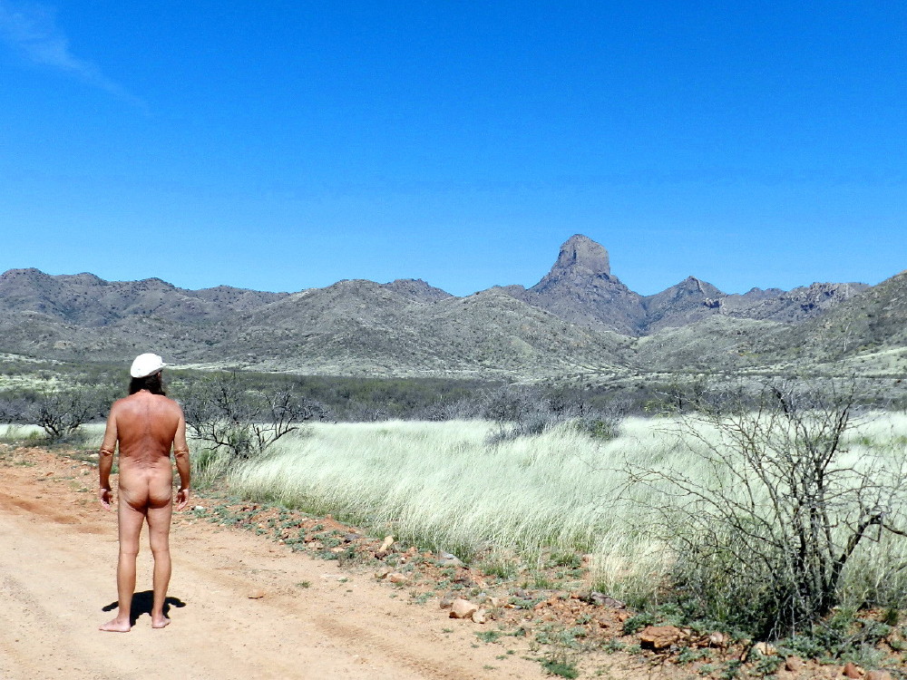
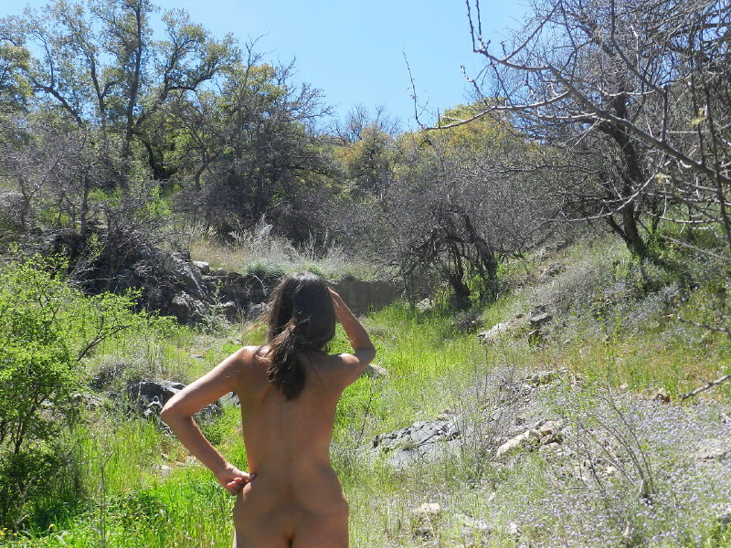
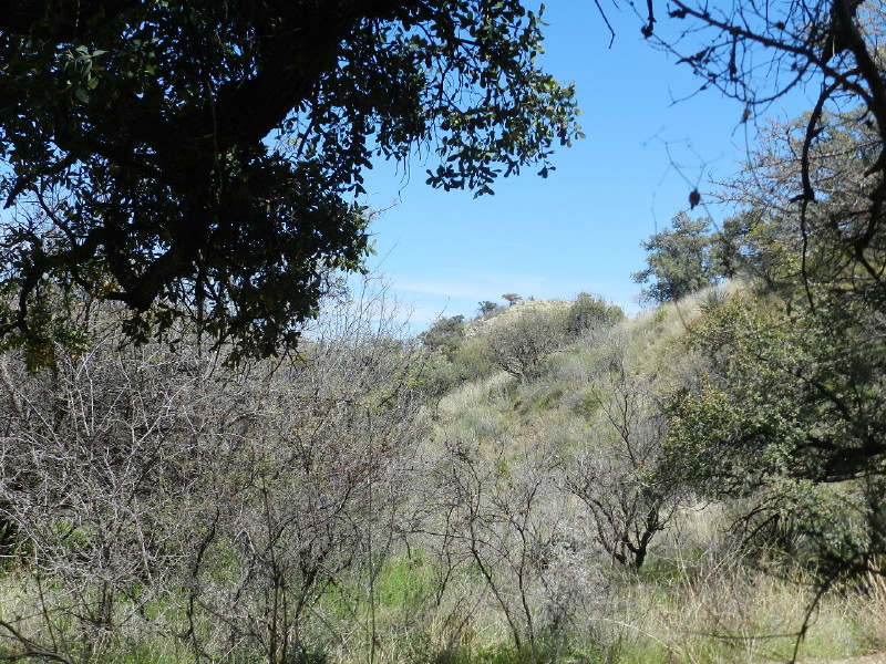
It is wide open spaces before us and very little human population. We know that there is a border patrol checkpoint and so we are keeping coverings near. We see a typical desert sight in the foreground , scrubby tortured mesquite with a sparse carpet of low plant life and grasses. The background is a view up at the telescopes of Kitt Peak and the natural landmark, the sacred mountain of Baboquivari. We hope to find our way up to the later.
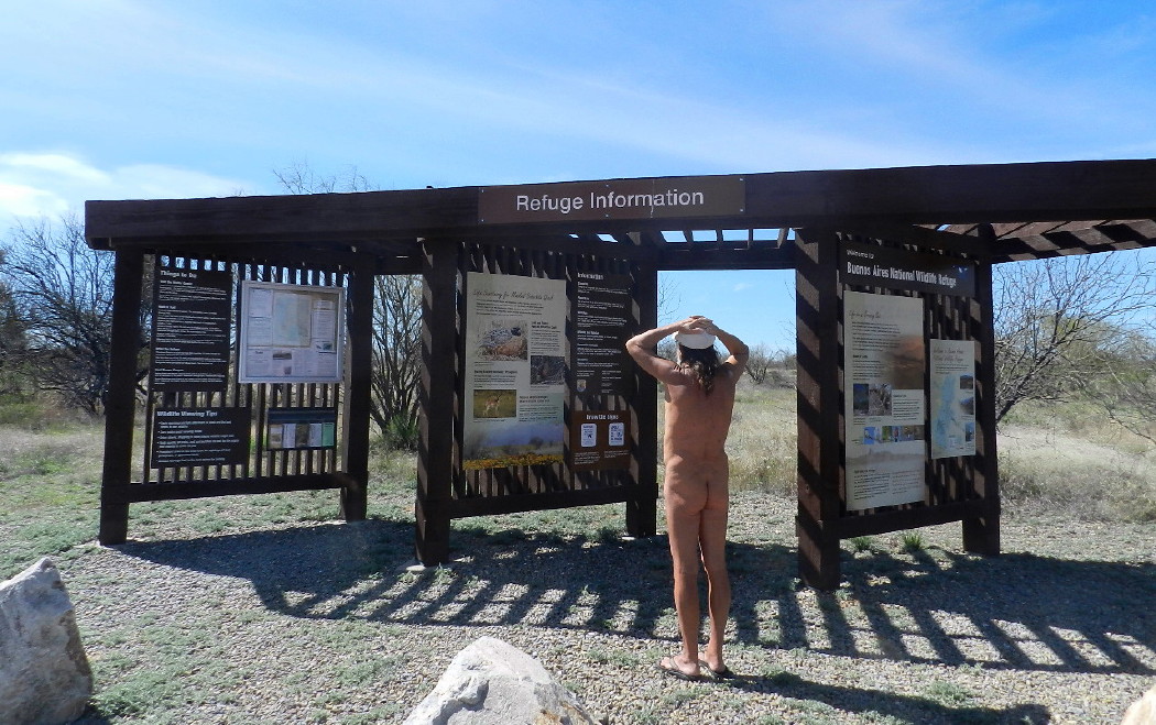
A road sign welcomes us into the Buenos Aires National Wildlife Preserve.
Just after a turnoff for a dude ranch, we are slowed at the Border Patrol road block. As we approach, the signs demand that our speed diminishes, fifty-five miles per hour, 35, 25. There is no stop when heading south.
After this minor inconvenience, we are feeling free on the open road. The traffic is even lighter than usual as everyone is in self-imposed isolation for the pandemic. This entire day, we will see only two civilian vehicles and numerous border patrol rigs.
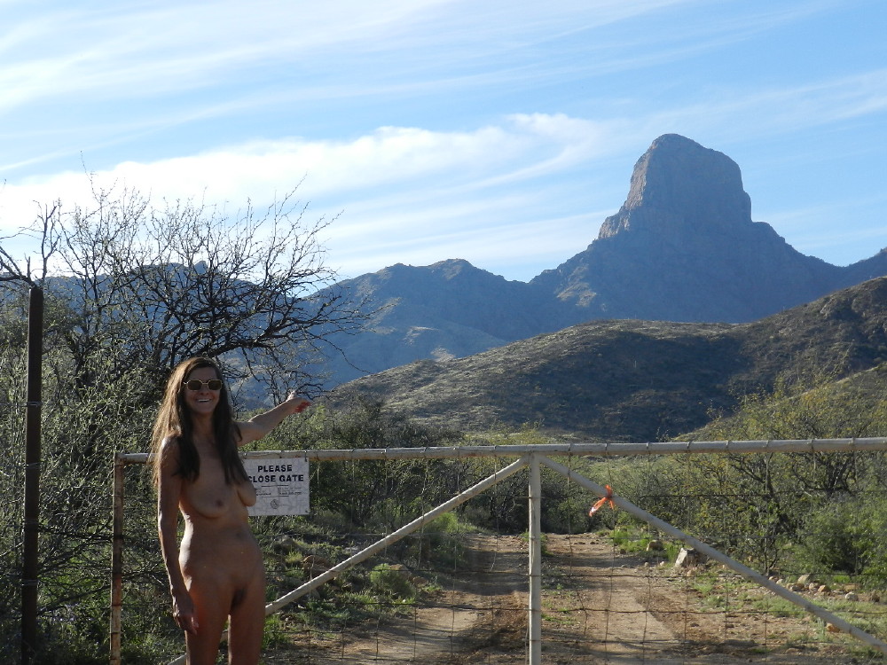
We pull into a parking lot where there is a kiosk with information about the wildlife preserve. I situate the SUV to help block the view of any passing motorist on the highway. I’m reasonably comfortable to get out and wander, expecting to browse the information without interruption.
They have re-introduced a quail that was once thought extinct. The terrain is hopefully being returned to a pre-settlement condition, with herds of pronghorn sheep and various other critters that were devastated by cattle ranching.
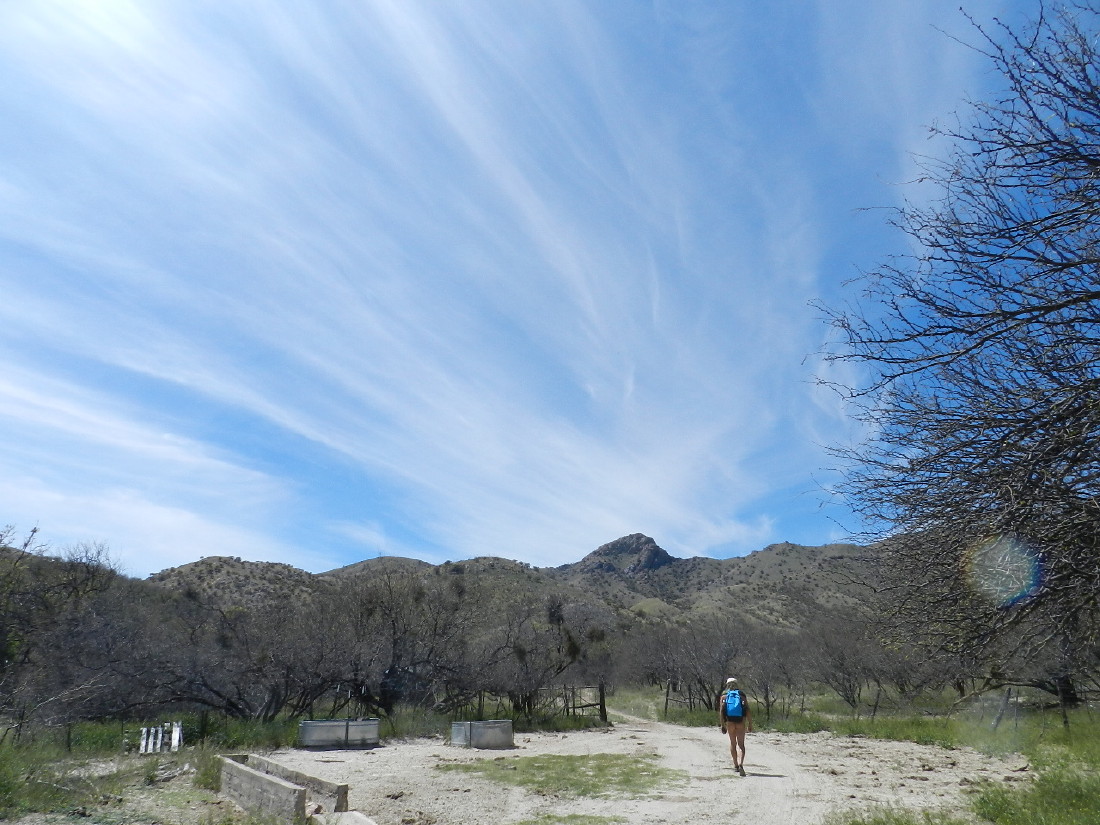
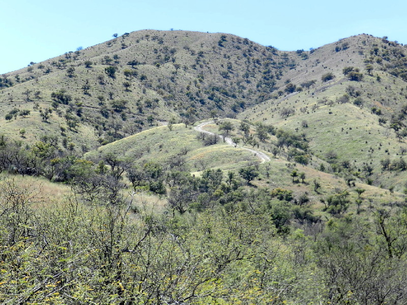
We have only a vague description of a road west of the highway and a preserve, which leads into the mountains near the Baboquivari Peak Wilderness. When we pull off at a cattle guard and continue on a graded dirt track toward these mountains, my best GUESS is that we are heading up Thomas Canyon.
We are driving through fields of tall dry grass, which remind me of wheat fields. Occasionally scrawny mesquite bushes pop up. There are the occasional ocotillos, bare of green leaf they are merely clusters of sticks with needles. Many however, still have remnants of the orange flowers on the pointed ends.
The terrain eventually reminds me of our trip to the Whetstone Mountains, where the scraggly old wintering mesquite grows leafless across the route and had created Arizona pinstripes on the truck. However, here the road is much better than four wheel drive on the trail on that past day, when a mesquite branch broke off my radio antennae. The Whetstone Stories (Pts. I,II,III) are in the archives at the right during April 2018.
We turn right, away from the gate, where a sign explains, “New Access” directing visitors away from the local cattle ranch. The mesquite becomes thicker and taller. Two wheel dirt tracks and the vegetation creep in closer. This must be the preserve created by the Nature Conservancy.
It is only a few hundred feet to where we come to a gravel wash and a loop circle to turn around in.
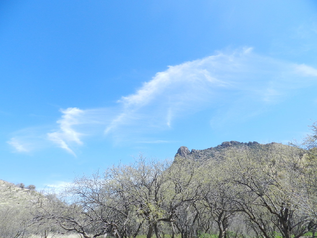
I park the truck next to a tree in front of a sign that refuses to allow access to motorized vehicles. There sit several large rocks in a row, blocking the way. We find that we are actually parked in the wash. With a complete cover of azure blue, no rain is expected. “Well, this must be it.”
There is just the sound of wind and a few birds here and there. Then for moments, a powerful swoosh will take over.
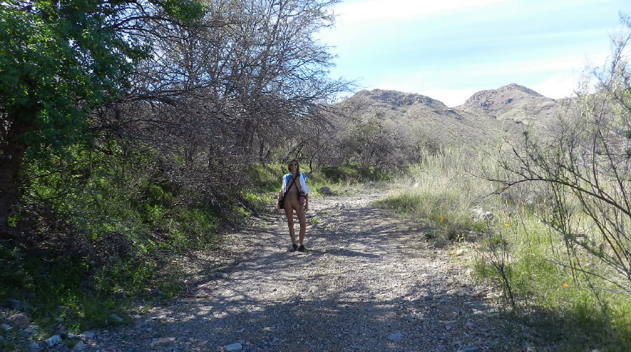
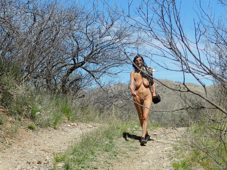
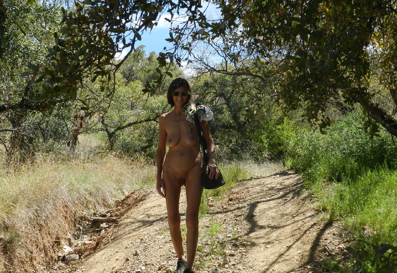
I slip into my toe shoes. We hear the crunch of our feet with every step. A bed of sand and pebbles lie in this wash.
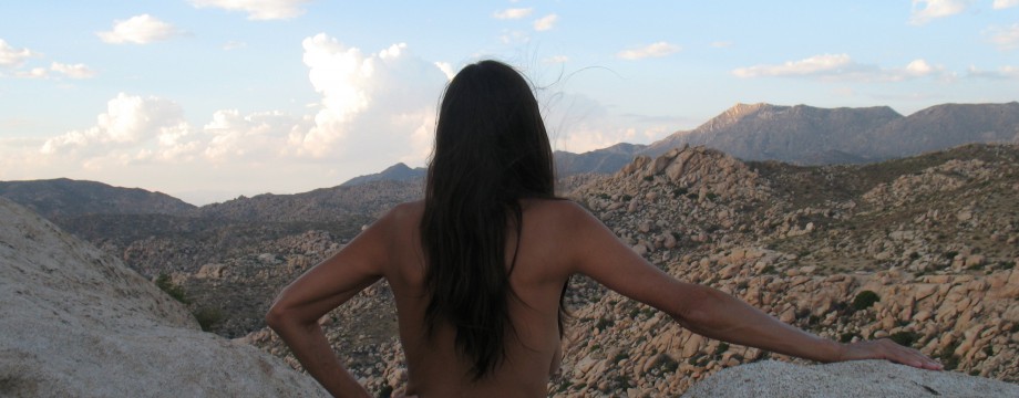
Passing through an area in a truck is one thing, as details passed by so quickly. Stopping and walking nude is a wholly different experience. We were insolated by steel and plastics. Now, everything is so much more alive, unique in detail and real. I can smell and touch every change in this world with every sense of my body.
The dark gnarly mesquite and dry grass give a grey dark colorless tone to the area. Then, as a solidly black butterfly flutters by like a shiny three dimensional shadow, my eyes open up. I see the world in its contrasts. I discover that my first impressions have clouded my perceptions.
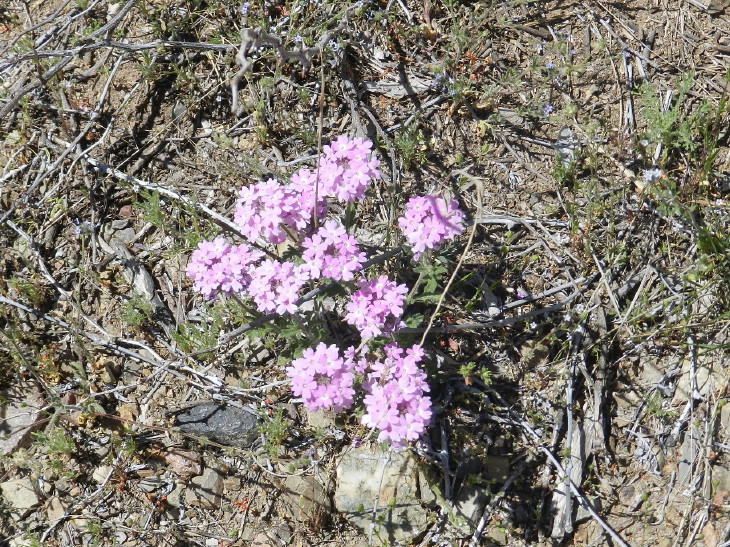
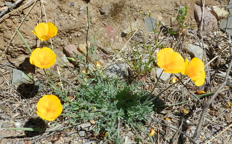
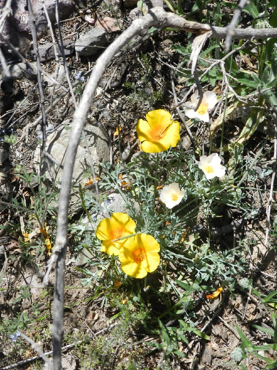
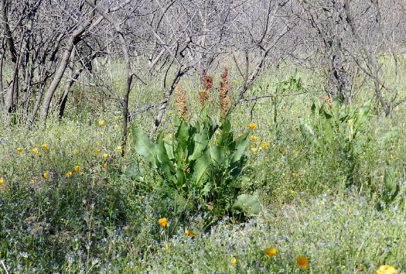
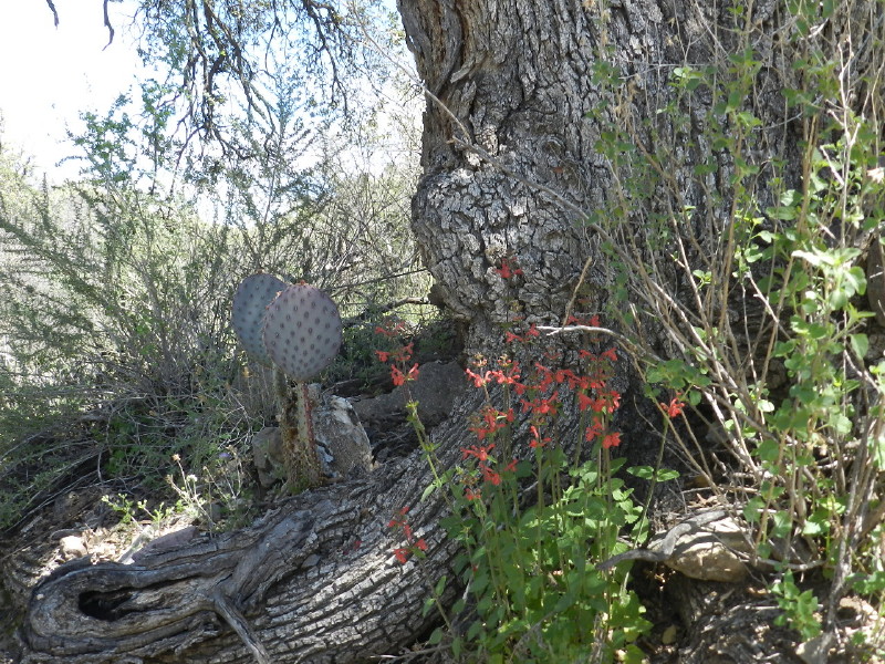
Protected in the rich soil under these barren trees in this riparian area, the grasses and the green plants that have shot up from winter’s rains are now blooming. Everywhere, they dot the landscape. There are little spring patches of lavender and everywhere the florescence of the yellow and orange desert poppies.
Here and there, purple towers climb out of this. Winter is changing to spring.
I unwrap a sandwich. Rather than sitting to eat, I begin a walk about the area. I am entertained.
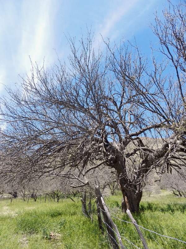
There is one distinctive tree. Barren stick branches protrude with dainty bundles of budding and rich young green spring leaves. Over all, it is a mass of fresh spring fluorescence in the forest of wintered gray mesquite. The leaves are too new to show distinction. I can’t identify the plant. I stand there munching and watching, identifying with the energy and renewal of the season. 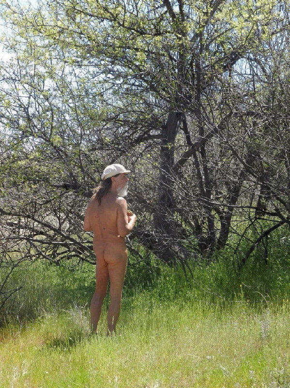
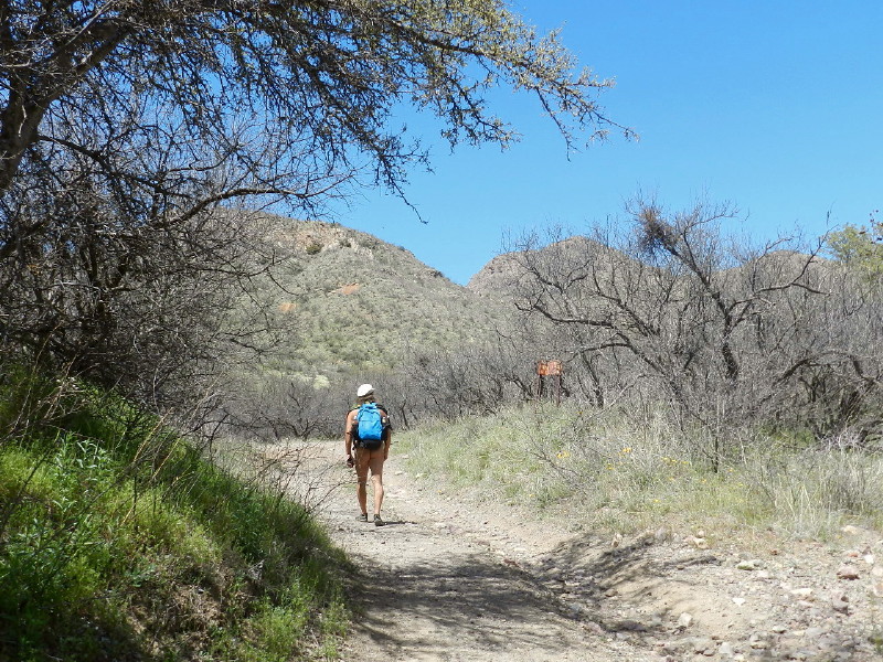
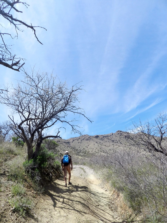
We embark up the trail, which is merely a wash. This will keep us away from the local rancher’s life, but add an extra 1/3 mile to our day’s quest.
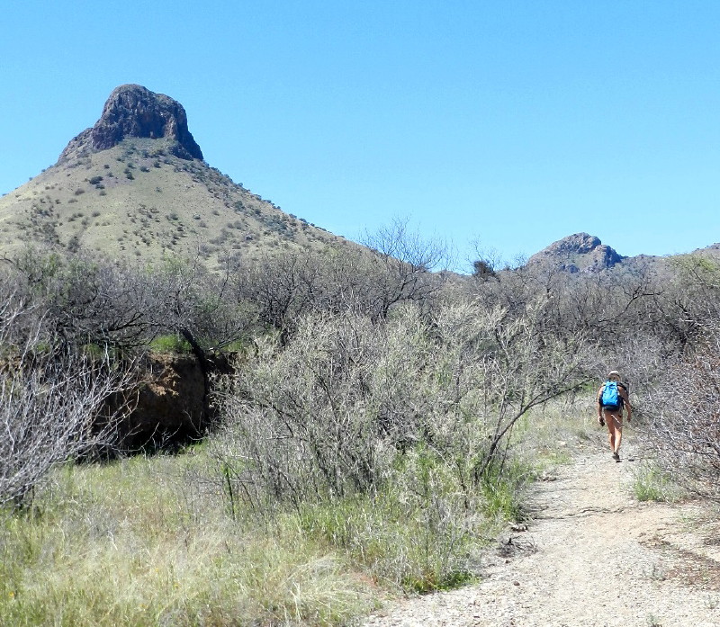
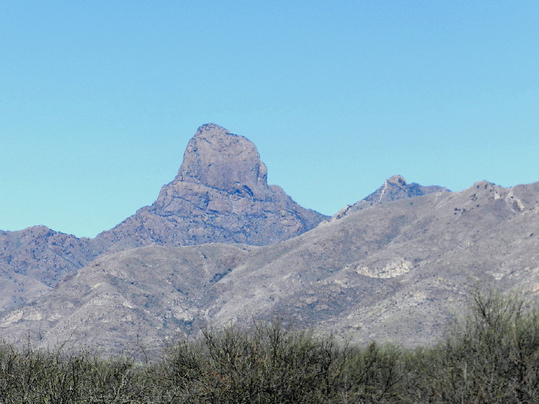
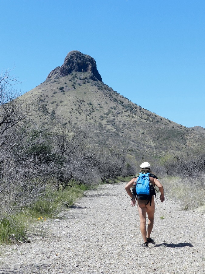
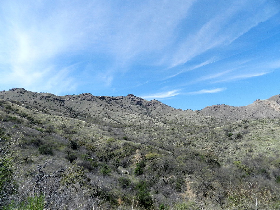
Walking in this wash is generally as if on a paved road. Only some of it is more akin to a beach, where our feet sink into soft deep sands causing us to trudge. Up ahead, framed by the mesquite lining the wash, is a smaller version of Babaquivari. The eons of debris have collected into a triangular slope with a huge nipple atop. This granite peak’s form, not yet eroded, is a remnant of an ancient layer. Debris lays at it feet, where a collection of landslides have stretched out like a giant skirt. Along the horizon of this slope, there are silhouettes of tiny trees, which are probably distant scrub oak. The coming canyon may be forested with these trees and hence, there would be more shade, as we progress.
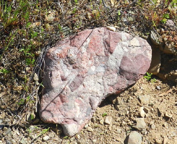
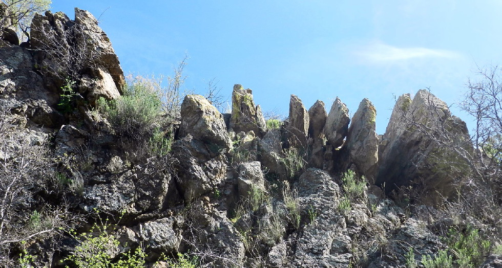
In the wash, there are conglomerate rocks of pink and purple. Purple seems the dominate color in the area, dotted with many other colors. I suspect that we may be treated to some interesting geology, today. These are fun looking rocks.
It feels hot, as the bright sun is radiating into my back and shoulders. It is supposed to climb to around around 82F today. There is however a contrasting chilling wind. It comes in bursts. The trees prevent its full force, but on occasion, it is clear enough, the wind is free to blow across us and we receive a light shiver. Each time, we can hear it approaching in force down the canyon. After a period of anticipation, it engulfs us all over in its passing.
The contrast of wind and sun makes a decision on what to wear more difficult, but right now, nothing at all is working fine for us.
I am thinking that I hear a car out on the road approaching and the potential for a visitor. It is just a strong wind traveling up the road. At noon and having seen no other cars parked at the trailhead, we expect the whole place to ourselves, unless the rancher happens by. We may, or may not hear people on horseback. Sound can carry on the wind.
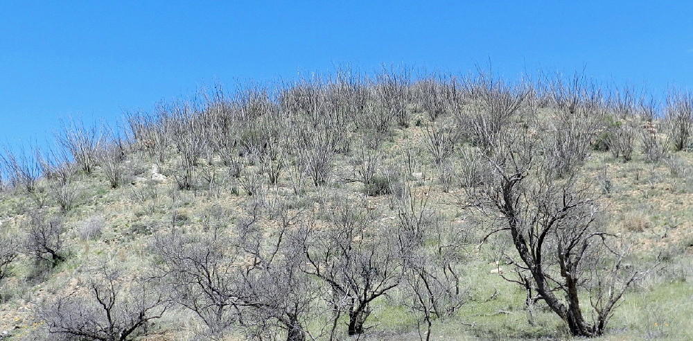
We pass a hill on the right, which has grown ocotillo, as if hair. It is a forest of the spinney sticks.
We see a telephone/power pole and a silver steel roof in the distance and so, place a quick cover in hand.
The stretch of trudging through the wash ends where it meets a dirt two track road. To the left it crosses a tall berm. Beyond that, we see the top of a corral and several trailers. Our route is to the right.
We begin to make time, walking easier on the mashed solid dirt surface. We want to make good time. It appears that Baboquivari is miles away and uphill.
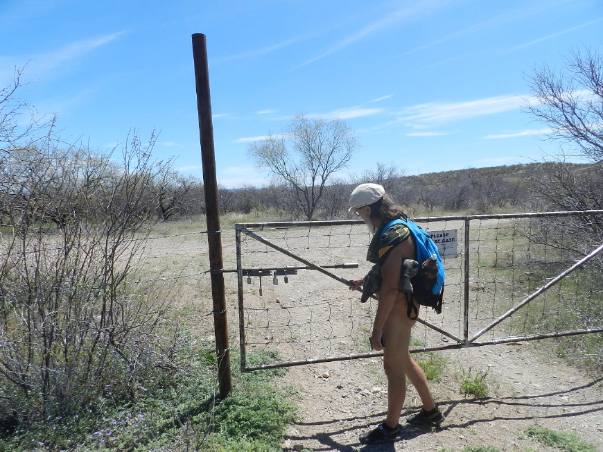
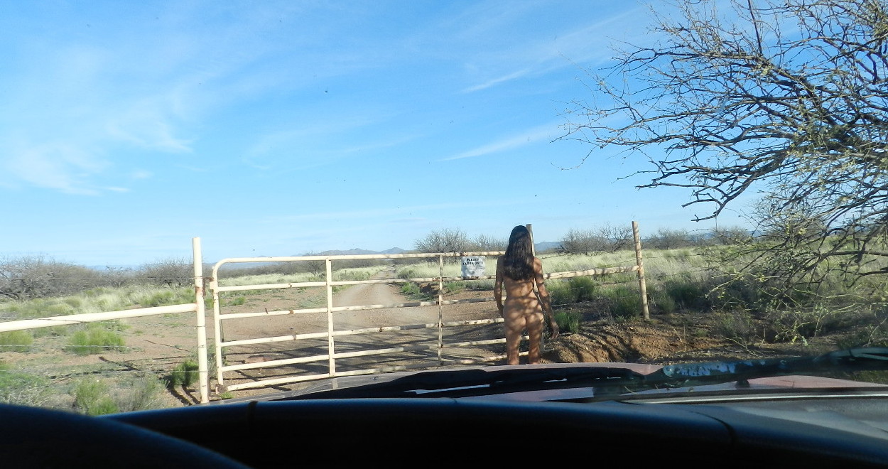
Very soon, we arrive at a gate. There are several locks dangling from the apparatus and a bar that keeps it closed. I’m concerned, but very soon see that they are mostly decoration, the keys and combinations long lost. The bar actually slips out of the containing hole easily, like pulling on a fosse ball bar. It even has a handle.
Traveling through this old mesquite log fenced corral, the road continues through a mesquite valley in early spring. Along the way, we see a barrel cactus, the first seen in this region.
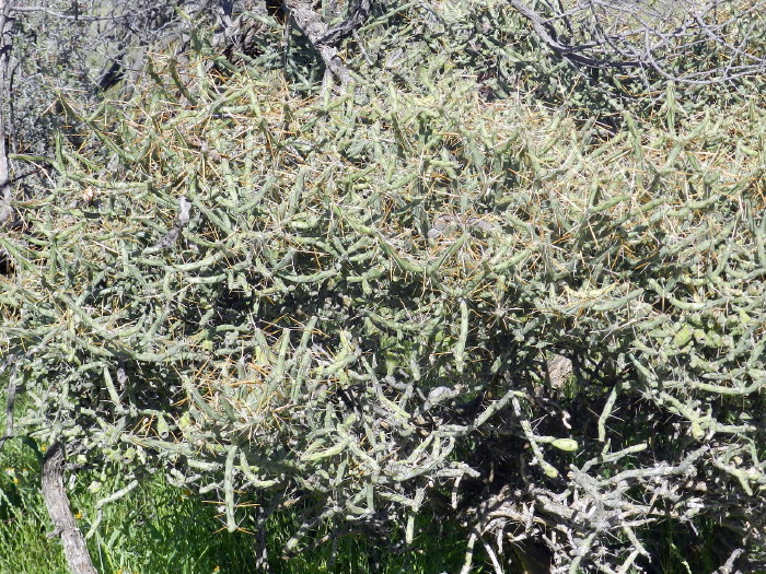
There is an unusual cholla. It looks to be a Christmas tree cholla, with its bundles like Christmas ornaments, but this one’s spines are very long. It is a thick large bundle and not in character with what we are used to. There are variations in any species, just look at humans, but this one is a freak, a genetic drift to a great degree.
Ahead, to the left, low in a tree, I see a hawk sitting. It calls out repeatedly. The wind is carrying the sound. I see where the hawk sits, but its call is coming from the hillside far to my right.
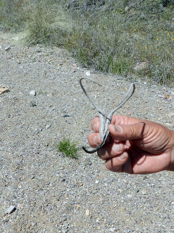
We find a devil’s claw. I love these things. They remind me of my life as a child in New Mexico. We would play in the desert next to White Sands Missile Range and hike up to Sugarloaf Mountain. These odd seed pods were abundant.
We come to a fork in the road. We have no topo maps and no directions. We are blinded by these large hills and have our desire to reach the sacred mountain’s base. With the potential of a hidden valley and a hidden route, we chance to take the left fork.
The sign says, no camping within a mile of the water tank. Another Whetstone Mountains trip’s reminder.
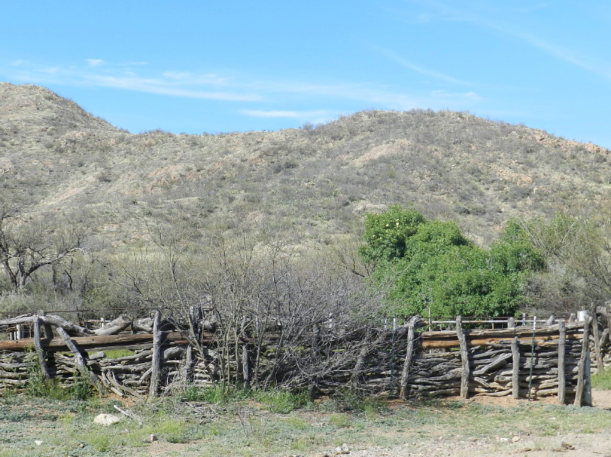
This leads us to an exceptionally large mesquite tree. It is as fat and tall as any. It is a lord with a realm, sprawling over a barbed wire fence and a corral.
A rustic looking windmill is turning above a couple of water troughs for animals. There doesn’t appear to be any resistance in the blades as they spin quickly and silently in the breeze.
We hear a force of wind in the distance, as it approaches from up the canyon. The blades pick up speed, blending into one circular mass, as they rapidly spin around. Then, we see the calm set in.
Continuing, this road takes us through a rich riparian valley. No water is seen, but the rains have created a lush forest with verdant floor.
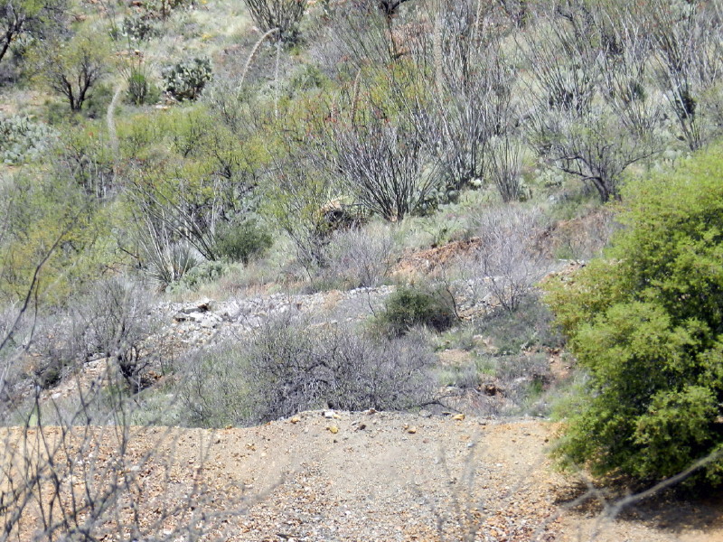
Above on a hill, we see the excavation of a mine. Coppery yellow brown and orange debris are piled on top of an older rock wall. This place has been dug more than once. We can see that stones were laid by hand as a wall to support a road up there long ago. These are now mostly buried under the powerful work of heavy equipment. It is now smoothed out and straight on top.
We climb up the steepening road to see where this leads. Could it rise above the valley floor and then swoop down into the next, turning toward our destination?
Does it continue up and south and away?
At a lookout, amongst the green and the grass, I see nothing of a road in the distance.
There are only a couple of old mines, the copper brown falling out and down the mountain like some very large animal dug them. We do see a road high above us to the south, quite the opposite of our intended direction. It looks like we have taken the wrong turn.
We are out of our way, time is shorter and if the other fork is what we are looking for, it is a long way to Babaquivari.
It is a good day. We are enjoying ourselves and we have that itch to see what is around the next bend and then another itch to see what we can see from the top of the next hill. We can get back on a correct path at another time. Our story has changed.
We do follow our curiosity through a wonderful landscape. The road becomes steeper and there are a few treacherous spots that would be quite risky for my 4-runner. Walking however is safe and much less ruinous to the calm of casual nerves.
We bump into more and more fun rocks among the rubble of the churned up road. We find some quartz specimens with various colored veins, some very shiny, some with mica glowing silvery in the sun. We spot a chunk of rock with a turquoise color, a harbinger of copper. Still, I wonder if the mines were for copper, or gold.
This is Food
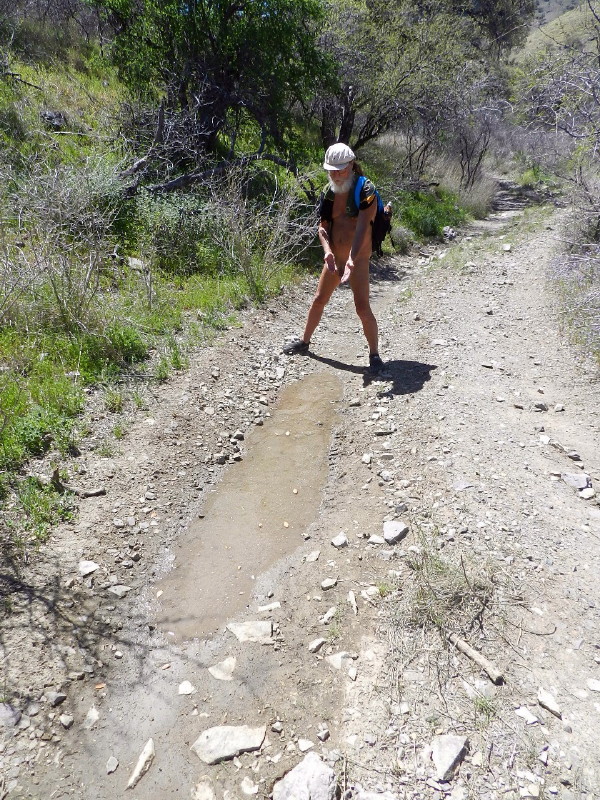
In the tread marks of the road, we find some water. It is curious as to why. The cattle have turned it to muck, water bugs are in residence, but it is water in this parched time.
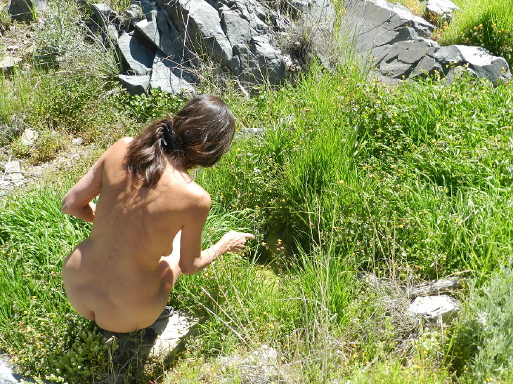
Not far along, I find a streak of green grass, hoof prints deep in mud and water in a creek. DF strips off what she carries on her shoulders to explore, handing me the camera.
I am interested in an endangered cactus and the beauty of a tangled tree root, but I soon follow her.
We find the stream flow not surprisingly meager and an old concrete dam.
DF climbs up to inspect, but there is no ponding, just this seepage.
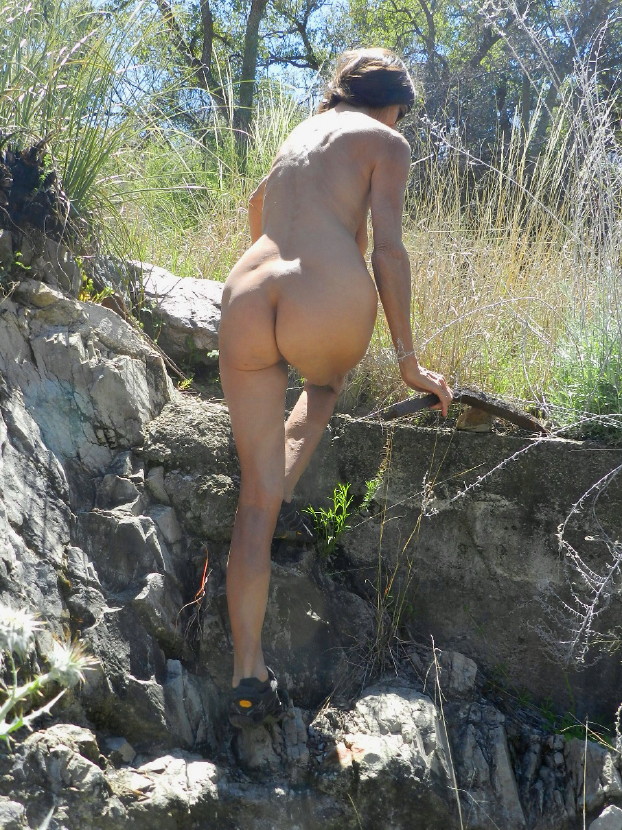
I scout the road up the hill and call to DF to follow. I have found that there are shade trees and it is pleasant. Looking further up the road it is steep. We decide to take a rest.
We notice a box on the side of a tree.
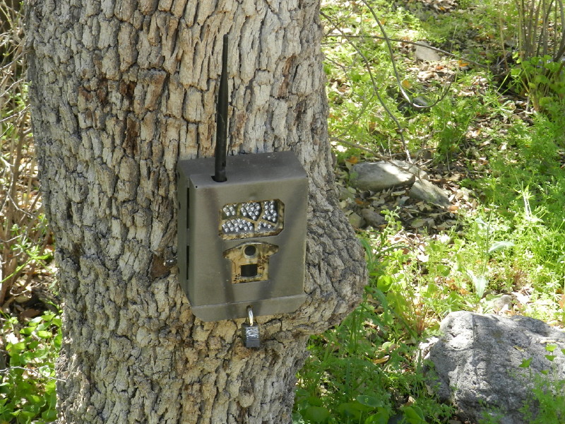
I tell DF that it is a game camera. She gets closer to have a look, before she realizes that “game” means animals, not toys. It is set to monitor wildlife, we figure. Perhaps it monitors illegal crossings from Mexico.
We have a laugh. Someone will be surprised to have naked people on their screen. We find two rocks big enough to sit on and snack in the shade. They are the only two and they happen to be on the other side of the camera. We must cross it to get to them. Oh well.
It is very pleasant here, quiet, comfortable.
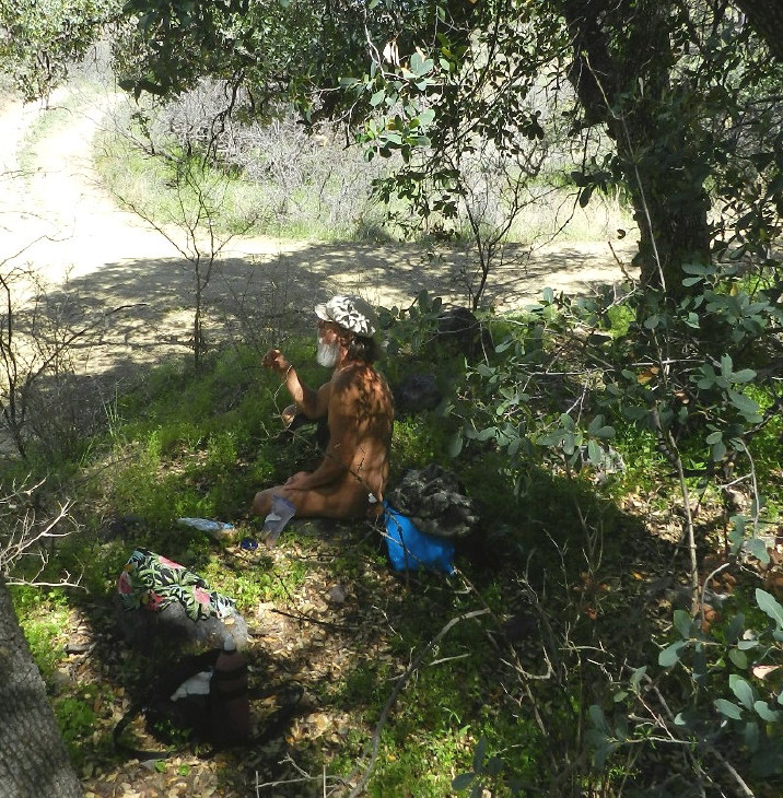
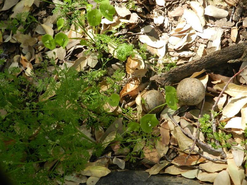
An unusual plant is growing around us. I find a pair of some kind of organic balls next to me.
This is entertainment enough as we relax.
We decide to head back and if we feel like it, investigate the other trail at the fork.
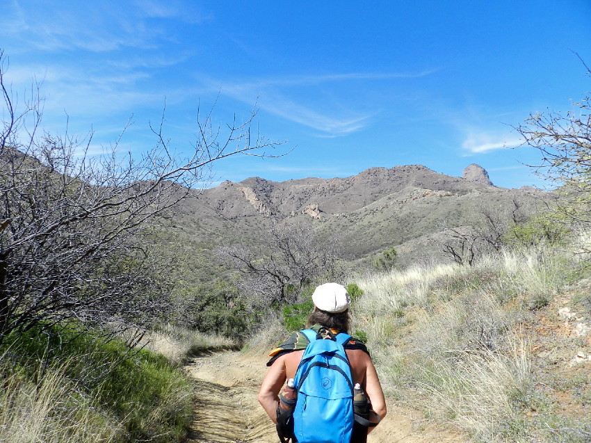
The walk is just as new for us on the way back. The little Baboquivari has become quite impressive, as it is rising above.

The sacred peak itself has an ominous grandeur, as it pokes up above the surrounding hills in the distance, as though it is a gargantuan being looking down on us.
At the fork, we turn and try walking up the other road. We come to an interesting rock hillside next to an empty wash. We explore that a little ways.
We’re getting tired. It is too far to our original destination and there is plenty to look at in this region, if we have some extra time. Our friends are nearby, who sometimes host a sweat on Sundays. We have options.
We arrive at our SUV and take the road back out. We had passed a fork in the road before and decide that there is time to explore it. We take the rough rocky route back a few miles, until we come to another gate.
It obviously goes much further. We’ll save that trip for later. It is getting late and we have received news that the sweat is on.
At the sauna/sweat know as The Turtle, we soak in our perspiration, relaxing the muscles that we abused today.
Postscript:
We were not hiking in Thomas Canyon. We were by the Schaffer Ranch. We hiked up Weaver Canyon and then a little of Jupiter. We now know how to get to the base of Babaquirvari by road.
The other fork that we drove at the end of the day was leading us through Thomas Canyon. There is a trail past there which may be on private land. There may be a cow trail to a water tank near the base of the monolith. We’ll get there eventually. It may be from the west side of this range. There is plenty of land out here to roam, all with full senses and natural freedom.
Be sure to click any image to enlarge it as you desire.
© The owners of TheFreeRangeNaturist.org as of the year 2015 declare. Unauthorized use and/or duplication of this material without express and written permission from this site’s author and/or owner is strictly prohibited. Excerpts and links may be used, provided that full and clear credit is given to TheFreeRangeNaturist.org with appropriate and specific direction to the original content.

Pingback: Weaver Canyon | EcoNudes
Pingback: Weaver Canyon – The Shaven Circumcised Nudist Life
Pingback: Weaver Canyon – Nudie News