2018-04-07
The Earp Vendetta Ride was a search by Deputy U.S. Marshal Wyatt Earp, leading a federal posse, looking for outlaw Cowboys that they believed had ambushed and maimed Virgil Earp and killed Morgan Earp. The Earp brothers had been attacked in retaliation for the deaths of three Cowboys in the famous “Gunfight at the O.K. Corral” on October 26, 1881. From March 20 to April 15, 1882, the federal posse searched southeast Cochise County, Arizona Territory for suspects in both Virgil’s and Morgan’s attacks. Several suspects had been freed by the court, owing in some cases to legal technicalities and in others to the strength of alibis provided by Cowboy confederates. Up to this point, Wyatt had relied on the legal system to bring the Cowboys to justice. Now he felt he had to take matters into his own hands.
They managed to capture Florentino “Indian Charlie” Cruz. He confessed to have taken part in Morgan’s murder, and he identified Stilwell, Hank Swilling, Curly Bill and Johnny Ringo as the others who killed Morgan. Cruz ended up dead from gunshots after the confession.
The Earp posse unexpectedly encountered Curly Bill and several other Cowboys cooking a meal on March 24, 1882, at Iron Springs (present day Mescal Springs) located in the Whetstone Mountains. Wyatt returned Curly Bill’s buckshot gunfire with his own shotgun loaded with buckshot. He shot Curly Bill, almost cutting him in half. Curly Bill fell into the water by the edge of the spring and lay dead.
Curly Bill Brocius, was a gunman, rustler and an outlaw Cowboy in the Cochise County area of the Arizona Territory during the early 1880s. In his journal written in October 1881, George Parsons referred to Brocius as “Arizona’s most famous outlaw”.
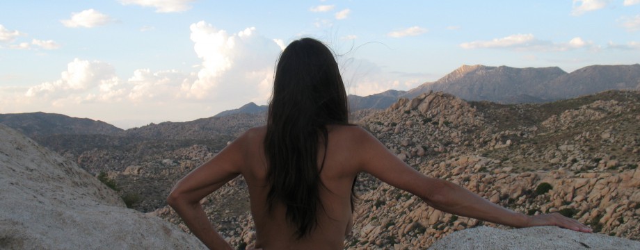
One hundred and thirty-six years later, we are going to investigate the scene of the shootout…naked.

May the road rise to meet you,
May the wind be always at your back,
May the sun shine warm upon your face,
The rains fall soft upon your fields.
May God hold you in the palm of His hand.
Traditional Irish Blessing

The Whetstones
There is an amazing amount of conflicting information out there. If you are curious try “William Brocius” and “Earp Vendetta Ride” in Wikipedia, or google for more. It is the Wild West in Technicolor. We are carrying these conflicting “facts” with us on our exploration of the Whetstone Mountains and speculating about the scene. We have often speculated about prehistoric and Native American lifestyles, by placing ourselves in their environments, naked. Of course the nude aspect bears less relevance to these cowboys of the 1880’s, but then roaming about, nude is just always preferable. It also gives insight by the contrasts as I’ll discuss later. I didn’t find this place by looking up Wyatt Earp, I was looking for a new playground to have some fun as a naturist.
Getting there:
We leave Tucson casually Saturday morning and take the fast highways to the intersection of traffic lights near Huachuca City, in the grassy prairie-like high desert area of Baja Arizona.

The carnuding trip has been uneventful, except when an accident had brought traffic to a standstill and a semi-truck driver slowly sat beside us. A casual draping of cloth was sufficient. At the intersection we turn west toward Sonoita and then shortly turn off into a rural neighborhood. The road turns to dirt. We then find ourselves on a long straight and flat road called Sands Ranch Rd. This is a good time to stretch and switch the wheel locks into 4×4. Two whitetail hawks hover over as I stand in the middle of the road. The breeze is light and I can see for miles across the expanse in the direction of Tombstone. Cradled in this valley below us, lays the San Pedro River.
In our more immediate vision, if someone were coming, I would see a cloud of dust half a mile away down the road, either way. Breathing in wide open spaces naked, we feel our freedoms.

In preparation, I had only found the location of what had been Iron Springs, which is now Mescal Springs, through google satellite images and markings. There also appeared to be a road leading up into the Whetstone Mountains.

We’ll Head Up there on the Second Day
One of the few other intersecting roads meanders out west near a wash and it appeared to sometimes be in that wash. There we expect to find a place with trees and hopefully shade and pleasant solitude.
At the bend of the road, at the ranch house, the quality of the road surface becomes as a jeep trail. It is difficult to figure what is what and going where. We come upon a barbed wire fence gate and beyond a few hundred feet we can see another, with a sign. It is going the correct direction. We take a chance, hoping to find what we need. There aren’t but three roads in the general area. As pitiful an example of a motorized conveyance that this is, the odds are with us that this will be our planned route.
Not seeing any life and brush obscuring us from the buildings, DF gets out to unlatch the loop of wire that keeps the rustic gate shut, as is our custom. It is soon apparent that she will need help. They haven’t made this easy. The aging combination of barbed wire and old mesquite sticks falls away, collapsing and has to be drug across the earth and out of the way. I bring our truck through and then help reattach the loop to the fence post.

A second fence announces U.S, Forest Service lands. This is a good thing, because it is most likely not patrolled regularly by any government entity, nor a rancher, that might object to our nudity. I know from my maps that we would encounter a National Forest, but the road markings and the boundary were very obscure.
Encouraged, we begin our trip. Our heads shake in concurrence as I say simply, “This place is all ours.” This was suspected to be a bad road, but this is a bouncing, baby carriage ride. There are multitudes of large sharp sided rocks to constantly dodge, least I may get one through my sidewall. A flat tire would ruin the trip. The going is very slow and for me as the driver, very occupying. There is a comment between us, “If this is the good road, then…?”
We find our turnoff which drops down into a wash area filled with dry wintering mesquite trees. Few leaves are to be seen.
A pleasant day, we let the windows down and allow the air as we slowly find our way.
The mequite basque is thick. The dodging of the overgrown branches is soon added to the dodging of the sharp sided rocks. This video game in 4×4 low gear seems to be unending. When a set of branches swipe the truck, my retracting radio antennae is bent back and ruined.

My rear-view mirror gets pushed back toward me and the screech of the Arizona pin stripping is relentless, no matter how well I strive to stay clear of damage.

The “Road”???
We will need a campsite, a base for exploration, but all we see are rocks of all kinds and tilted slopes. The obstructions are so numerous that there is no place to even turn around. We just have to stay the rotten course. When we finally do find the one opportunity, we stop. We can’t be sure how far we have come, or how far that we have to go, but we will walk from here.
Off on Foot:
We take a break and gather our fivefinger shoes to our toes. We take only water and cameras. There is a cooling breeze, so the heat of the day is no problem. Now, after having endured the gauntlet, there is a charm to this rugged spot.

We begin projecting ourselves into the 1880’s starting with the nature of today.
I am bringing a list of questions to our investigation. How could a guy like Wyatt Earp chasing in a posse and outlaw cowboys with heat on them, have come within 30 feet of each other in surprise? What visual, or auditory impediments could there have been. Was Wyatt maybe lying about Curly Bill shooting first at short range and missing? Was he just getting justice in a vendetta for his brother? How could Curly Bill have missed Wyatt with buck shot at such close range, because buckshot spreads so much? Was this a common route to the railroad tracks to Tucson, or did people commonly take the road to Sonoita and Nogales on their way to Tucson? Why were they surprised, as they said, to find these cowboys at a popular watering hole, in an area with few reliable water resources? We are here to get details and maybe conjure up some speculative idea about that day.
Throughout this day notions will occur to me about all of these questions. What did it feel like in 1882 and what was going on?

We smile, enjoying the temps. It is a pleasant spring day, quiet and calm.
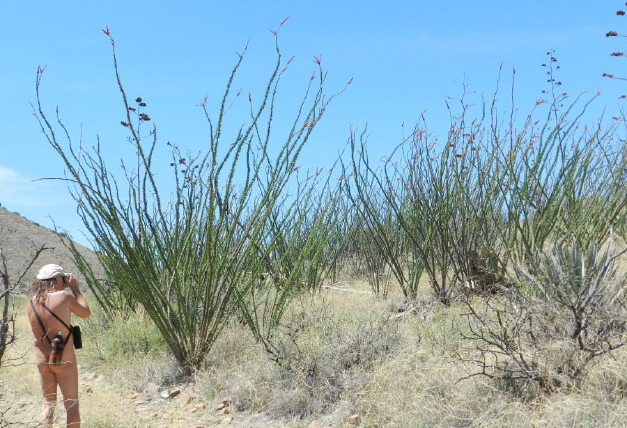
The Ocotillo are Unusually Thick in this Spot
We step out wondering if this time of year in 1882 was also as pleasant. What would it feel like in dark felt hats with wide brims, leather boots, heavy pants, or perhaps chaps? Did they actually wear vests, long coats and tight necked shirts? Would they just be wearing a light blouse with bellowing sleeves? Would their dress give them more fatigue in heat, even cloud their thinking.

The terrain is more of the grasslands, which slope down from the mountains and hillsides. There is now mesquite around the wash and some scrub oak. Ours has been a historically dry year. There is not any abundance of water.
One hundred and thirty-two years have changed the area’s ecology. This place has been ranched with a heavy hand, eroded. I know that our wide Pantano River and many other forests were totally destroyed to harvest firewood. This could have been a different place if the water flowed slower and topsoil let water seep in.

This place today is just a mass of different colored rock with some sediment built up over millennia and then washed out. What can make a living does. There are few large trees, but many of those are very old.

Multi-color Rocks in the Wash
Roots are unburied and now grow bark after being exposed. There is a deep gash forming this dry creek’s path.

There had been descriptions of cottonwoods. There are no cottonwoods for many miles. Not one, but other species are abundant. If they grew here, they would have come back before the scrub oak. There are very old trees here.

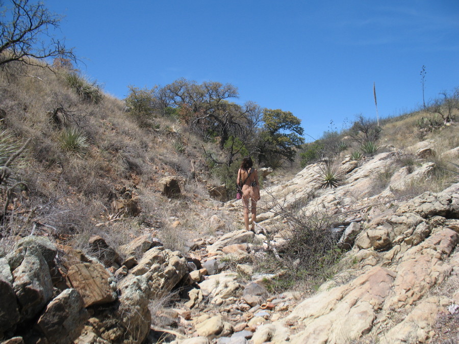
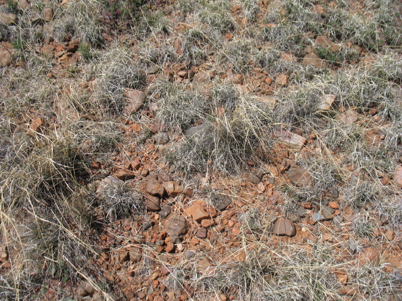
Thick vegetation like trees would slow travelers. It would make sense to travel on the ridge line in the tall grass. Today, we find the grassy slopes are covered with tufts of native grass and everywhere there is the destruction of the invasive species buffle grass. There are constant exposed rocks among this. The topsoil has been washed and blown away after being stomped and loosened by the unnaturally heavy cattle and their wide hooves. Perhaps, back in the day, there was topsoil and it was easier on the feet of man and horses. Our going is slower because of the rocky terrain.
Down in the wash there is free passage, but it is hopping from one rock to another.
The passage is winding. Every 30 to 100 feet there is a bend, a twist in the route and the possibility of a surprise. We know this being naked, surely the figures of the 1880’s would also have their reasons to be cognizant of this.

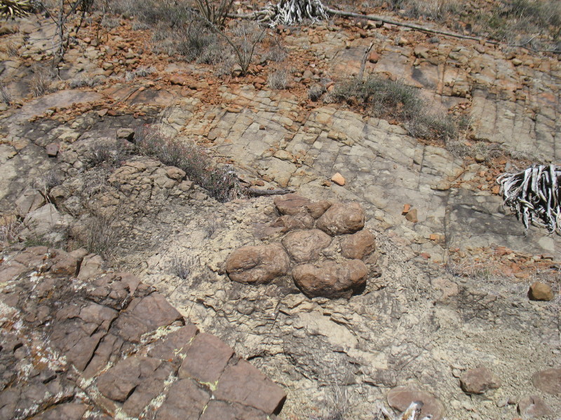
DF Finds that She can just Pick and Pull the Slate Out
There must have been a frequently traveled trail through here. The water hole is ideal for its distance from the last water in the San Pedro River. The route cuts at a diagonal, mostly directly in the direction of Tucson. This notion was nailed, when I found an 1881 dated map, with the route on it. So, why did the two parties not expect that someone would be resting at the water hole?
Today, we are in an isolated place and very free. There are more than 100,000 more people here than 132 years ago. At that time this spring had to feel even more remote. Could this be a reason why neither party expected to bump into the other? Could they have been that stupid, tired, or ignorant? We’re out here without any clothing save shoes and with no concern. I can understand that they might feel similar lack of concern. It is the nature of the place.

We walk on as the jeep trail guides us up a hill and out of the wash. On this ridge it is still rocky, but years of traffic have mashed down the rocks and it is almost a cobble stone effect.

Red Rock like Cobblestones
The cobble stones bring us to an area where the stones and the little topsoil is reddish in color, which is a clear sign of iron in the makeup.
Grass and Red Rock, Topsoil is Gone
Could this be the reason that the spring was called “Iron Spring?” The economy was cattle and mining. People, miners involved, would have knowledge of geology. They would note that this is iron in rock as is their perspective was driven by their occupation. Could we be getting near the spring location?
We come across a round concrete cattle tub. There had been one in the proximity of the spring in the satellite image. This may be it. There is other evidence of water works over years, but nothing recent. There is also a thick mesquite patch that makes the nearby trees look thick, as to be impassible.

We decide to continue heading west. There is an old cow path heading uphill, next to and through the wash. Fairy dusters are three different colors here.

Typical Pink

White

Hot Pink
We end up on top of a ridge of golden tall grass flowing in waves in the wind. Occasionally there is an agave, or yucca.

Agave
Sometimes a mesquite survives. The vista has a soft flow about it, and a feeling of vastness. We enjoy the moment and the photography. In the distance we recognize the road to Sonoita about three miles away. Why would they go that way to Tucson, when this is a better route?
I have my back turned to DF as I speak to her. She doesn’t hear my voice. The winds interfere. The name of the adjacent mountain range is Huachuca, which means windy spot. There are usually winds here. Could these be a reason that Earp and the cowboys didn’t hear each other until they were 30 feet apart? On the other hand, when it is calm, our voices naturally soften and become less audible.

There is plenty of this grass of clumps with a tall wheat-like structure.

Nonindigenous buffle grass is poking at my nude body waist high. It is sometimes uncomfortable. At one point, the dominate species is short. There is more apparent representation of a more genuine example of native species interacting. It is easier to walk on and in.This often occurs after a fire cleans up the ecology.

We have enjoyed ourselves, but we are reminded of lunch and decide to make our way back. We travel a different way to reach the wash and follow it back. We find ourselves lost in a different parallel wash and when we correct, we have arrived at our camp.
There is no shade coming from the barren trees. We huddle next to the truck for shade in our folding chairs, listening to the wind and then between, silence. We watch clouds change and travel by and we ponder. The high overcast has turned to wispy high clouds, since we started our adventure in the morning.
There are two stories running here. One is the speculation of 1882 and the other is more purely nature-ist. I need to taper down the workload, so I’ve split this particularly long and challenging post. In a few days, I’ll publish Part II. Our story shall find new clues and some answers to our mysteries. We had fun.

Outstanding! Can’t wait for part 2.
LikeLike
Another wonderfully informative article about southern Arizona and it’s tumultuous history.
I have spent most of my 60 years in Marana, Avra Valley and Tucson areas and traveled extensively throughout Southern Arizona. Me and my girlfriend (CB) have visited many of the area’s highlighted in your articles, we now feel the urge to own a 4×4 and venture even further back into the beautiful Sonoran wilderness.
Perhaps, someday, we will cross paths with you and your wonderful girlfriend DF.
LikeLike
It’s great that you so freely share these adventures. Looking forward to Part II.
LikeLike