2016-06-04
Friday afternoon we are on our way to the Pinaleno Mountains. At the base of Mt. Graham, 9300 ft. is the trailhead for Ash Creek. A tough hike, but worth the effort, or so I had read.
Remember, the images fit better and get sharper if you click them.
We’re traveling out I-10. The familiar billboard signs for “The Thing” are passed one after another. They have been an enduring piece of Americana for decades, like the old Burma Shave. I remember chipping in for gas and coming way out here in high school to see The Thing. “What was The Thing?” you might ask. It is a curio shop with a mysterious door leading to…The Thing! Not having missed a return to the apparent two headed chicken which probably died a long long time ago, I do see a sign for Dairy Queen and my stomach steers us into the parking lot. A quick kilt wrap and t-shirt and I’m dressed for the first time in a couple of days. The bribe is a soft ice cream, twisting and nearly falling off of the sugar cone.
I wander around the shelves while I eat merrily and messily, managing to not drip any, but collecting one dollop after another in my now sticky mustache. Fireworks are stacked up in one section and the kid in me takes a curious inventory.
As DF shows up, I turn to her and point out the stuffed jackalope for sale. I always wanted a stuffed jackalope, ever since I was a boy in New Mexico. “Hey, would you like to buy me a stuffed Jackalope? Their only $219 dollars.” The last time that I had seen one of these for sale was 1980 something and the price was half as much. The joke produces a grin and a, “uh, nope.” But, as a consolation she points to the sign on the door stating that one dollar will gain us entrance and a viewing of the mysterious “The Thing.” She produces two paper bucks and we follow large yellow footprints down a concrete sidewalk. I looks as if Bigfoot had paid a buck to see “The Thing” before us and accidently stepped I some fresh paint. There are dusty antique vehicles lined up in a hallway, unusually carved pieces of driftwood, comedic wood carvings and a few guns from the 17th century, all claiming to be unique, or one of a kind. Then… in a case with a glass top…there, the mystery is unveiled…The Thing! Yech, gross!
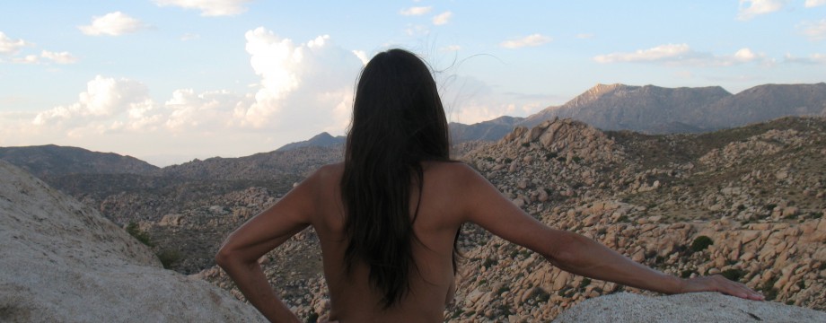
Wilcox Arizona isn’t far down the road, but I undress anyway. When we arrive, I cover the same way and we grab a quick veggie sandwich for a dinner, before moving on.
The winding road up into the mountains is just as long and winding as ever. We reach our favorite camp spot, throw on some warm sleeping clothing and set up a quick dome tent for the night. The idea is to get to the trailhead early. It doesn’t take much before we are dead asleep.

Morning:
The morning gets us our irritatingly usual late start and we don’t arrive at the trailhead until 11:00am. DF voices a concern that the small parking area being full. The temperatures in our desert have been pleasant, only a couple of afternoons over 100F. But this weekend, a pressure will bring excessively high highs into the ridiculous one hundred teens. We had planned to have our trip in the Mt. Lemmon area, near Tucson, but changed these plans. I figured that there would be a flood of people from Tucson up there to escape that heatwave. The weekend up here could also have a bit more population.
When we pull up, there is only one other car in the small lot. There are two parties camped. The one to the left is a couple who are doing chores at their tent. The other, to the right, a family, is minding their own business. I see this as an opportunity to stand up and wrap my sarong around me, hidden by the car and the car door. Squirming around in a drivers seat, draping cloth under my butt and over is just a hassle. As I’m about to go into procedure, a young boy comes out of the toilets and begins to attempt to prop the door open with a large rock. I sit and wait. Oh well.
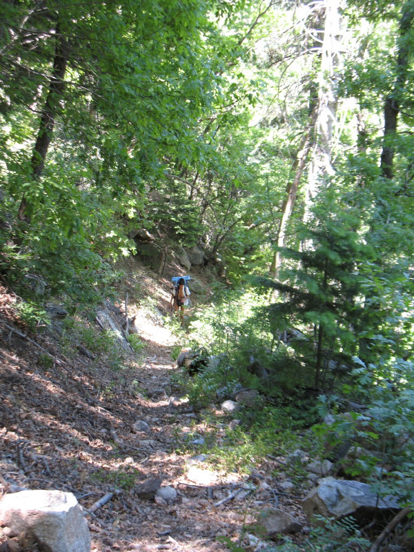
Already packed, we take off down the well-marked trail. It hasn’t long at all, that I realize that the campers aren’t roaming everywhere. The trail is long and it is steep enough to discourage people from hiking in, because the return hike out is all uphill. Most people won’t make the effort. Everyone in the vicinity is accounted for, but the other lone car. The sarong around my waist becomes a cushion and a sunscreen for my shoulders. I don’t expect to see anyone unless there are hikers way down the trail at the destination, Oak Flats. The air feels wonderful. It feels perfect.

Realizing the end of clothing for the day.
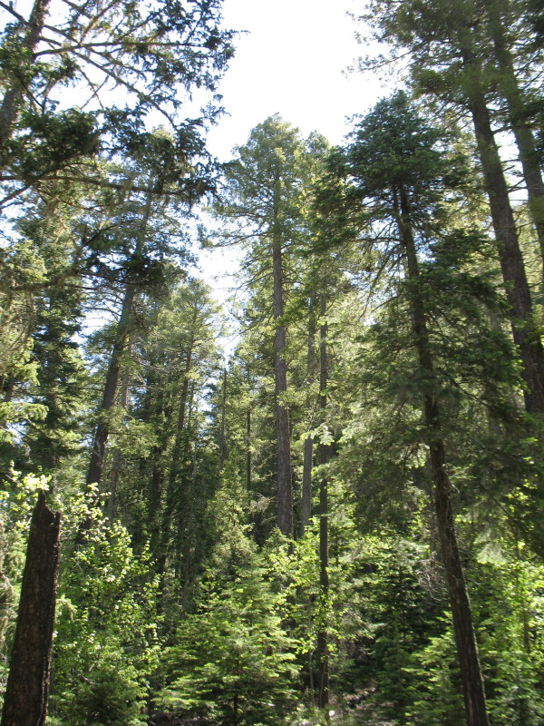
Soon, we hear the sounds of the creek. The trail becomes reasonably wide. It is an old logging road from the early 20th century. The forest is thick with wood fall. I have just one reservation. The trail continuously heads on a downward slope. Every step we take will have to be returned in an uphill climb. I knew this beforehand. I expected a difficult return. The sign is posted “four miles” to our destination, Oak Flat. My concept of a 2500ft. to 3000ft. drop is beginning to get a more finite education. Still, the beauty and promise of a lovely streambed walk seduces us. This has turned into a Rocky Mountain high paradise to walk through. The information, that I gathered, reflected this situation, “A difficult hike, with rich rewards.” “We’ll have all day tomorrow to climb out, resting along the way,” we tell ourselves.

Rock garden
As we continue through the tall forest, the floor is covered with brown moss. In many places the moss has contracted away from its rocks. The snow melt on this north facing slope happens very late, but there has been a long spring drought this year. When the monsoon rains come next month, this floor will turn green. It has the feel of a rainforest during those times. Mushrooms of all kinds flourish. We pass new sprouts of aspen, which are bringing the life back to the spots that have been destroyed by logging, fire and diseased spruces. The forest always regenerates.

Mushrooms on an old log
Traveling further it feels like the Appalachian Trail, or one of those old logging roads that roam through the mountain sides back east.

Elevation brings subtle ecological change. We are delighted generally. We pass through clouds of different scents, pines and flowers, something familiar like an old friend from pleasant times, or something tantalizingly new. They just appear out of nowhere, some are fleeting. Sometimes, I want to walk back and catch another whiff. More that once we turn to each other and ask, ”Wow, what’s that?”
A taller waterfall is heard and then seen. It is only a dozen feet or so, but an amazing sight after months of drought in the desert below. It lets itself be known, much louder than the constant trickling of the small flows through the rocks. It is covered with thick vegetation. We see it in glimpses through the trees and tall grasses, which cover the embankment that the stream cuts through. Sunlight streams through a break in the canopy above, highlighting it. I see the trail on the other side of the stream and the possibility of visiting closer.

The trail meets a tributary creek and we cross over on a line of smooth rocks as the flow runs between them. We stand, we rest a moment, we high five and smile.

Just down the trail, I listen and search for the waterfall. There is no discernible difference in the sound on this side. The steep slopes and the thick vegetation have captured and carried the sound of it away. It has disappeared in the thick foliage. I’ve got a sense, like this forest has given us that promise, that there will be an abundance of delights down this trail. We continue on through this natural friendly park in amusement.

We find debris from the old logging operation at a fork off of the trail. It is thick iron, very industrial. This pristine wonderland was once sent to Globe and used to collect Douglas fir to prop up the many mining shafts and tunnels in southern Arizona.

DF looks at an rusting hulk at the crossroads
We take the right fork along the creek. The slope is slight, but all along, the trek back up is accumulating.

Tight squeeze under a fallen tree
A meadow greets us… There had been industry here. Remains made of metal dot the landscape. I surmise what each bit was originally. I look for level areas and try to imagine the extent of the old lumber camp.

We know that the trek out will need to include frequent rests. In my head there is a growing list of possibilities, this is one. What lies before us is mostly unknown, to be explored.

Mountains and Valley Far Below
I have accumulated only a few highlights for guidelines. We have little to go on to estimate how far that we have gone and how much further. There are a few landmarks, varying accounts of distance, the occasional sight of a distant ridge to measure as the crow flies. We also have our sense of time and distance, but also much uncertainty.

Pacman in the Sky
Not far down the trail there is a fork. A forest service sign posted the trail going up the hill. Also, someone had placed sticks across the trail in arrow shapes to emphasize the point. All point is to say, “do not go down the stream.” My information told us that the fork is one for horses and one for sure footed bipeds.

We take the directions and soon find ourselves heading up a steep switchback, climbing several hundred feet up a ridge. It is exhausting. The trail runs somewhat level around the ridge. Long dramatic views of rugged ridges stretch out in a panorama.

As we look out, pine gives to scrub oak, and then vegetation adapted to lesser elevations and then out into the valley west of Safford. Farms are only square patches, buildings are dots, as if we are flying at 8000 ft. Mountain ranges are seen across the valley, one peak after the other, out into New Mexico and the Gila Wilderness far into the distance.
Then, the trail drops, just as it had risen, in a sharp switchback through pines. Pine needles coat the trail here. They are thick. Where the sun peaks through it is hot. We are much lower than we had been and the afternoon highs are giving us just a taste of the excessive heatwave below us.
The switchback stops and we find a slight fork with branches laid to direct us on the main trail. It is where the other trail comes out after wandering down the creek. We continue down what appears to once again be the old road, until we hear the unmistakable thunder of a waterfall. There below, a cascade slopes and then drops a couple of hundred feet in a couple of sections on a wide piece of granite.

We look for ways to see the falls from our vantage. Boulders cover our view, but protect us from the steep cliff sides. The tree tops below hide the falls. We jockey for position to get a photo of the whole, but after that switchback climb, I find that my legs are twitching and the once ultralight backpack is swaying my balance. There is a long way to go to Oak Flat. We can now see that. We decide to start investigating.
This has been a rocky trail. Now, it gets more so, on this slope down.

The grade has increased. We are now getting into lower elevation ecosystems. It is warmer and we can’t surmise where Oak flat is.

Pondering Where Oak Flat Is
After somewhere around three quarters of a mile, to a mile, we are feeling a sense of the difficulty of what we are doing. There is an equal distance more to drop, at the least.

Somewhere Down There
We have less than two liters of water left. We haven’t been at Creekside for quite a while. If there is no water at Oak Flat, we would be in hazardous trouble, perhaps deadly.

Very rugged here. Do we climb up or down?
We are in the mountains to escape the extreme heat. We will have to climb out of this decent the next day, too. I reread what directions that I have. It doesn’t promise water explicitly, just flats and campfire pits and shade. It is an unknown. A decision has to be made. We have to turn around, get to water; perhaps the other trail will be near water.
We trudge our way up the hill.

It is three quarters of a mile, like stair steps made of uneven granite and dirt. It is arduous. I look behind and see DF bent over, a serious expression on her face.

Her stomach is getting hit. This is still a high elevation.
The air is much thinner here. We rest. We make a tea with electrolytes, we rest and endure. Along the way, we rest taking many a photo opt.

We eventually return to the water falls. The thought of getting up that switchback hill is daunting at this point. We are reaching our limits, which have seemed only a step or two away, for some time now.

We’re definitely in a bind here. I’m going to leave you with a cliff hanger, until next week. This story is just too long for one sitting….
