2020-03-08
Here we are, it’s Spring again and a first warm opportunity, a perfect day has presented itself. We were looking for a hike, to enjoy our deep tropical tans. Just over a week ago, we were in Zipolite, Mexico. Spoiled, we’re after sand, water and more of that terrific sense of liberty.
We have to stay down in the desert, because elevation makes the air much cooler up in the mountain’s trees, at this time of year. We also, want to try something new.
Redington probably has water from the recent rains. We thought of hiking the sacred mountain Babaquvari, but that is such a strenuous hike. We just feel like taking it somewhat easier. There is fresh ground up past Redington Canyon that would be new to us. We’re off.
There are quite a few cars already as we arrive. I have to park up the hill a bit further and walk a bit to get off of the road. So I drop my kilt on the back seat and wrap my sarong around me.

At the flood warning sign, I stuff my coverings into the backpack. I noticed that someone has painted over the clothing optional information, but one of the naturists who use the area have already painted over that. I don’t think that the Forest Service painted over it. It is probably the “Friends of Redington Pass.” They recently had a clean up. They would treat the announcement of nude recreation as graffiti.
As we stroll down the path, an apparent sound coming up from the deep canyon tells us that there is water flowing over the falls. We hear lots of luscious water.

The big surprise is the number of buds and flowers along the trail. As we continue, we find more and more variety and color. Spring has sprung, we realize. It is celebration. As we pass, there is a plethora of aromas for our olfactory faculties. DF’s nose begins to run. One of them is giving her an allergy. There is at least one allergy for everyone on this desert.

We decide to take the highroad to get deeper into the canyon and avoid detractions. Our objective is to get miles deeper into the foothills of the Rincon Mountains. The boulders, waterways, and fun along the way, will make the slow going, slower still.

The canyon shows us more flowering. Another week and this place will be in wonderland mode.

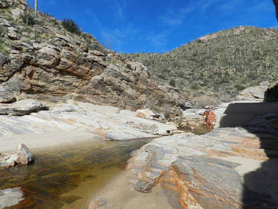
We are distracted immediately by the water flow, where the pools sit in the rock. I take the time to sit at what I realize is one of my favorite spots on the planet. There’s something about it.

We continue, fighting the urge to indulge our senses and pleasure and forget our goals.

We pick up on a guy who was dressed, when returning to the parking, earlier. At that time, he expressed concern of burning sensitive areas and pointed to his butt. He is there again, undressed. He has to be a first timer, learning the unfamiliar ropes to simply getting naked in the sun.

We take a break at our old camp spot, where a birthday was spent.

The place has changed dramatically. The four wheel people have been too into driving through, instead of crossing upstream. There isn’t much of a camping spot left. The water flow has changed. The big red rock where DF set up the kitchen and dining room is in the middle of the creek and a bush has grown over it.

It is here that we must decide what to do. We can take the stream bed up and boulder hop, or take the 4×4 road into the hills.

To take the road looks like a good walk and it meets another canyon according to the a satellite photos. We opt for that.

The road immediately begins to climb.

His route requires some special rock hoping equipment to drive it. To be going up or down at such an incline and then meet up with an exposed rock surface could flip most vehicles. It is filled with lots of rocks, consequently. They are rough on the feet, but more stable than the very slippery hard packed sandy loam.

We make our way up to a flat even stretch.

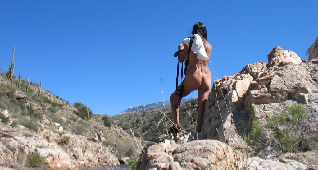
Here, the rocks are not kicked up by spinning tires. It has become a nice walk. I notice that I can see down into the canyon. Very tiny flesh colored figures may be seen on the smooth rock surface below, They are playing in the sun. There is a grand vista of Tucson beyond that.

Soon, we’re heading upward and onward again.
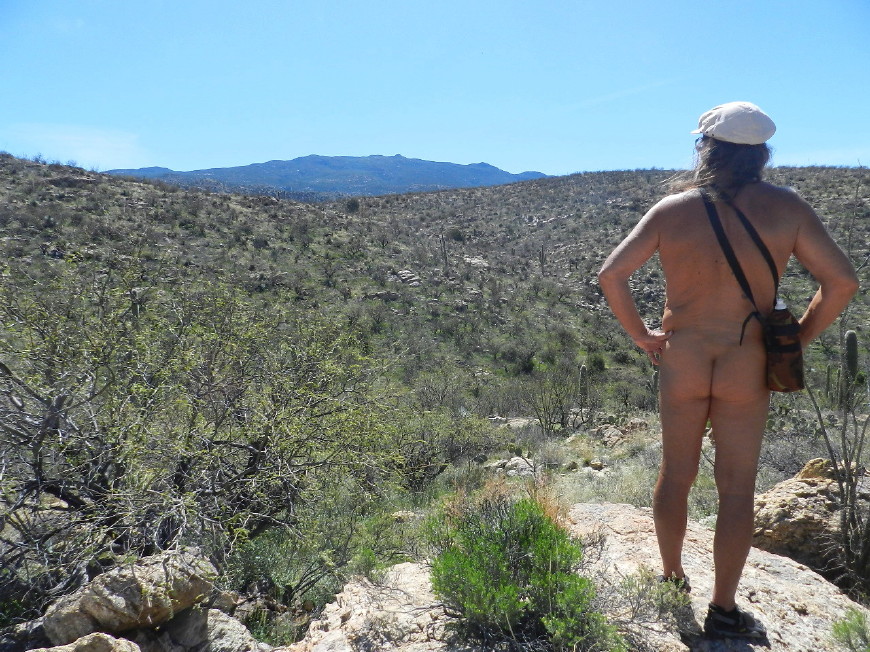
This terrain is grassland peppered with taller vegetation. The grass is interrupted by mesquite, ocotillo, and prickly pear, mostly. It is still in the winter mode, dry golden and grey bark. Just a bit more elevation further and a slope that faces the direct sun each morning, makes all of the difference. The vegetation becomes much thicker. Frost and freeze can’t stunt growth, or kill.

We discuss the lack of gratification in this climb upon reaching the top of the ridge. We see that there is little more than this high desert grassland beyond. There appears to be no fun new canyon, as I thought I identified when using satellite imagery. The road looks lonely and quiet.

The road just goes down and then back up another hill, as it winds through the grassland. We decide to turn back and soak out feet in the stream. A couple of miles of this is enough.
My vision from the satellite images also gave me the impression that we would be close to the feeder that supplies Redington. Taking off bushwhacking, or whatever one might call traversing without a trail naked, but for shoes, isn’t a safe option. I want to see if it is close for an alternative return. The couple of hundred feet to the top of the hill is a zig zagging move through a thicket. We proceed carefully. Between the thorns of mesquite and the prickly pear, it is a slow process. Everywhere, there is tall grass from last year, often matted down. I would never walk in this during snake season. As it is, we must be make care for old cactus prickers, branches and hidden rocks.

The crest shows me the wash is far below. It is through more of this mire.
It is quite a view. The wind picks up around us, as we stand alone looking out for mile after mile in every direction. Across Tucson, past the western Tucson Mountains and then twenty miles beyond, is Kitt Peak observatory and Scared Baboquivari.
I turn to look up at the Rincon Mountains to where the Pinion Pines start, and then beyond that, the tall pines of the mountain top. The landmarks tell me that we are near a section of the Arizona Trail, where it drops down from the high mountains through the valley and continues into the Catalina Mountains, before heading north. The world feels vast and diverse, open and free. There is nothing to object to our natural state. It is wild and it is home and it is harmonious. Above Sugar Loaf Rock at the peak of those darker green pine mountains, I can see snow fields. They are relatively close, the conditions that create them have more to do with elevation and sunshine. They promise that, Redington Canyon will get water for a while.
We make our way through the thicket, looking for small subtle recently acquired landmarks, a rock here, a familiar set of agave spikes, a sprawling pile of dead grey prickly pear spines that we had to step over ever so carefully.

The road going down is more treacherous than going up. Where there is exposed earth, it is a sandy loam, a hard packed collection of granite sprinkles, which fall loose. We can find a sudden downward slip where these small bits can act like a field of marbles under our soles. We spend many cautious moments. Where we can, we walk on the kicked up sharp rocks in the wheel grooves.
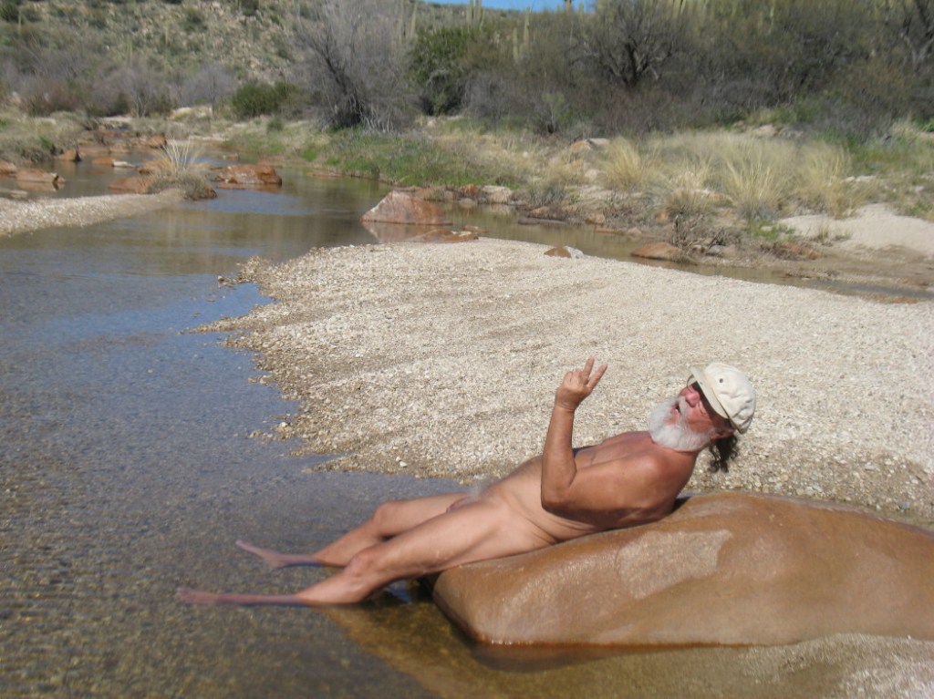
Eventually, we reach the water and shade, again.

From here, we decide to see how the Olympic size swimming hole is doing and find a place to soak our feet. Where the meadow begins and the glossy white bark on leafless cottonwood sit, the waters are calm and the air is still. The wonderfully peaceful silence is notable. The only sounds other than the occasional bird are us. The sound of the crunch of feet in sand, or a light splash of water, are all that we hear.

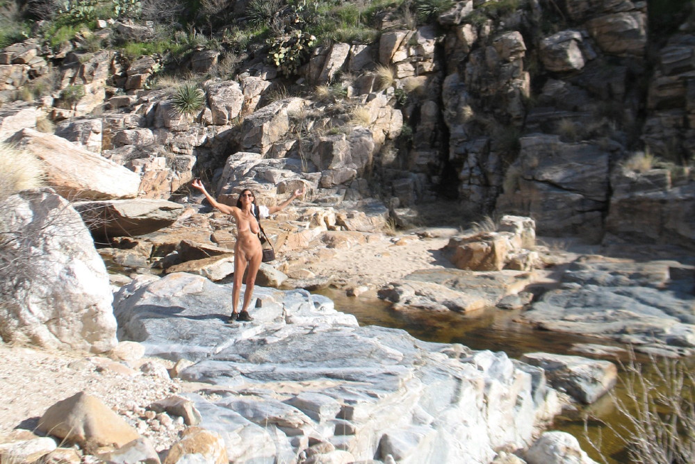
It is familiar here. The solitary uncharacteristic red rocks and the widening of the stream, are just out of the steep canyon walls. We look for ways to cross the shallow expanse.
There is a climb up a jagged rock to avoid the deeper chilly water.
We make a quick jump to the beach on the other side and continue to the pool. We figure that it is too cold for swimming, so we wish it well and return, as we came.

There is a rock in the seemingly still stream that looks much like a laying manatee with smooth wet skin. It is surrounded on three sides by a moat of shallow water. We take our shoes off and have a sit on our new best friend.

It is smooth and not too slippery, just right for lounging and just right for two.

I notice as I sit, that the sun has its surface temperature baked to perfection. DF lies down and lets it heat her back. The bend of it is ideal and stretches her spine, as it massages her.

The sand is gritty under the water, but I walk comfortably, sinking in deep, taking photos of relaxation. Then, it is her turn and she steps deep, past her ankles into the quicksand on the edge of the deeper stream. We have no chill in the water today.

DF comments that it is nice to be back walking, experiencing the sensations of the different types of sands, again. We had been living on a Pacific beach for a couple of weeks. Taking my turn on the manatee, I mention that “It is good to be home on these smooth rocks.”
We continue our relaxation on our friend the rock tete a’ tete feet in the sand and cool water. Looking up at the sky, DF asks, “So, where’s my mojito.”
The walk back has a terrific wind being channeled within the thinner canyon’s walls. It is threatening to blow my hat off.
We make our way past where our morning began and then further downstream into our more frequented spots.
There has been a change, again. Much of the sand is washed up from in-between the errant boulders. Sand is squishy, soft like silk, gritty, there are pebbles.
When we are back at the beach there is quicksand around the rock. We step on round boulder after round boulder, like uneven cobble stones. In smooth fields of sheets of granite and climbing on boulders, we follow the desert waters as they make the journey down the mountains to the Tanque Verde River and into Tucson.

The route has definitely changed, so we take a little longer than usual. We take a break at the popular beach, before getting up the hill to the car. It seems to take a little longer after walking most of the last seven hours in the difficult terrain.

Be sure to click any image to enlarge it as you desire.
© The owners of TheFreeRangeNaturist.org as of the year 2015 declare. Unauthorized use and/or duplication of this material without express and written permission from this site’s author and/or owner is strictly prohibited. Excerpts and links may be used, provided that full and clear credit is given to TheFreeRangeNaturist.org with appropriate and specific direction to the original content.

Pingback: Redington Pass and Beyond | EcoNudes
Great photos. Such a wonderful place. I’ll hike it again soon, now that the stream is flowing again. I, too, have long been curious to see what the stream is like above “the Meadow.” Satellite photos seem to indicate pools, but perhaps shallower than those below the old dam. Since the road doesn’t go anywhere near that upper canyon, it’ll likely be a matter of bushwhacking with clothes and good boots on.
LikeLike