2015-08-20
This morning even after sleeping later, there were still some mosquito problems, but that’s okay, it is good stimulus to break camp more quickly. The turkeys had snuck away to do what they do. I was still asking, “Did you know they fly!?” I didn’t know they did that!”
The next leg of our journey was before us, down a mountainous road, across dirt to the Blue River. We still had to search resources to make sure of what we were doing. We planned drive down to the Blue River to spend the night. The following morning, we would backpack 4.2 miles upstream to make camp. Then we would explore a very remote hot springs and canyons for a day. Another night in this designated Primitive Area, we would then return to the truck the following day.
For the Love of Water:
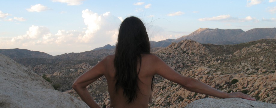
We drove down off of the hill and stopped at the stream where we had hiked the day before. At the trailhead, DF needed to do a water ritual for the project that she had been working on the previous weekend and earlier in the week. She wanted to be in sync with a few hundred other participants back in Tucson at a gathering. I knew that we would be up to twenty minutes with this. The place that she chose was the beach next to the road near the trailhead, where we had replenished our water supply the afternoon before. She slipped on a light sundress and I wrapped my kilt around me because the road was right there above us, if someone drove by. With me reading like an orator, she interacted with her heart and the stream in a sacred manner, holding her hands in the cold water in prayer. Above us a huge ominous deep gray storm cloud was coming up from the east. It looked like something from the mountain of Mordor. I wondered if it was a preview of the afternoon storm system that we might, or might not encounter.
Finding that we had had no need for the clothing as we finished, because no one drove by, Murphy’s law a failure, I began to unwrap.
Then two white late model Ford pickup trucks went by up on the road above us, creating dust as we left. All along this trip, parked in the forest, the fields and traveling along the dirt roads, there had been these white late model extended cab trucks, with men in camouflage uniforms and caps and military hair. It was kinda creepy, as if there had been an invasion of some secret Federal organization on maneuvers, or up to something. Rarely we saw any other color, or style. All were American made trucks like from a government fleet. It was uncanny. I’d hear something and tell DF, “Here comes another one of those white trucks” and from around a bend, it would appear. Another sub-culture, I suppose.
More to Discover:
The road that we were to take was not marked as paved after Big Lake on our new map. I was delighted to find that it now was a fresh smooth road. This would save a great deal of time.
We continued through the forests and meadows, hills, grand vistas constantly encountering evidence of the man caused Bear Wallow fire, now the largest in Arizona history:
http://www.azcentral.com/news/articles/wallow-fire-timeline.html
The same seemingly haphazard patterns would turn up, spots here and there, but soon we saw entire mountains scorched without respite. The intensity had been unimaginable. These sights would continue throughout the day.
We were off to Alpine, Arizona, a small town away from most anything man-manicured. It seems to exist to support summer cabins, a tackle/hunting shop, a grocery, a real-estate office and the U.S. Forest Service, Alpine District. We pulled up to a near empty parking lot. There sat only one forest service truck with no one in it. We squirmed in our confines to get dressed for “civilization.”
We stepped out of the truck. Alpine is surrounded by hills, or should I say mountain tops. All of the hilltops have a peculiar look about them. The alpine forest goes up the gentle slopes, but then there was a definitive demarcation where they would stop, yielding to a massive stand of stark burned sticks. It looked like a bad haircut. The town had been completely surrounded by horrendous flame.
Inside, we were greeted by a very young local woman, who was unfortunately without a clue. We finally managed to help her find a topo map and a district trails map. The experts were away at a meeting. Half of the information was not there, as it was in another ranger district. That other office was two hours away. We got some of what we needed, probably enough, but still had no idea what to expect in the designated primitive area of the Blue River, where the Hannah Hot Springs was to be found. There was a canyon and the elevation would be hotter.
With a soda pop and topped off tank of gas tank, we took off down Highway 191.
A Relaxing Respite:
We found a pull-off, a road into the forest, not long after leaving the town, which lead us down into a valley. We were after lunch and to get thoroughly undressed for the journey. There, we found a rustic corral, shade and fun mountain flowers everywhere.
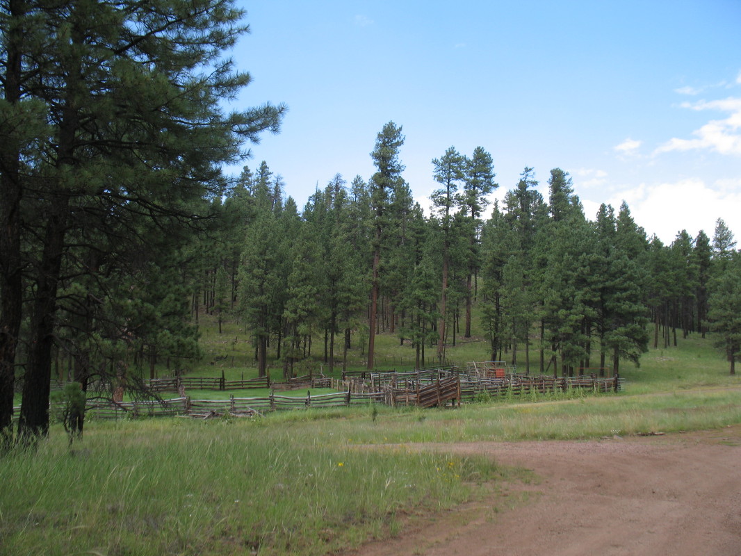
We stretched, gobbled down some sandwiches that DF had made that morning, relaxed and finished off the blue corn chips with salsa on the tailgate.

The sounds were few and peaceful.

The Devil’s Highway:
We traveled what seemed to be the longest stretches of mountain winding road ever. There are 68 miles which are listed to take over two hours. It is called the Devil’s Highway; it was once called Route 666. Watch this and imagine the Pine forests and incredible vistas looking far into New Mexico, past the extreme drop offs just past the edge of the roadway:
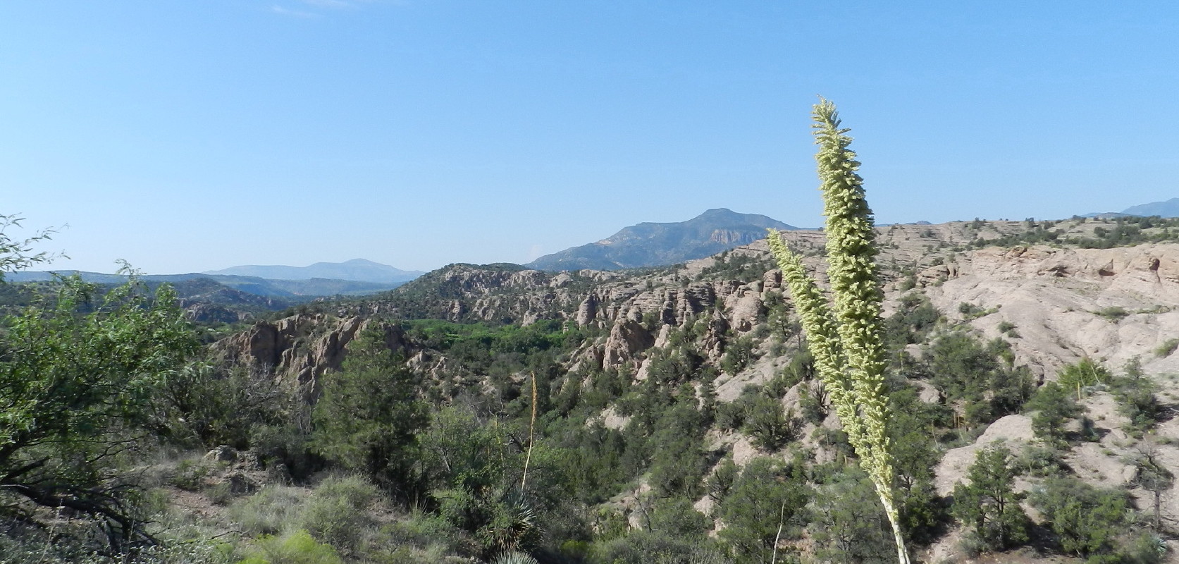
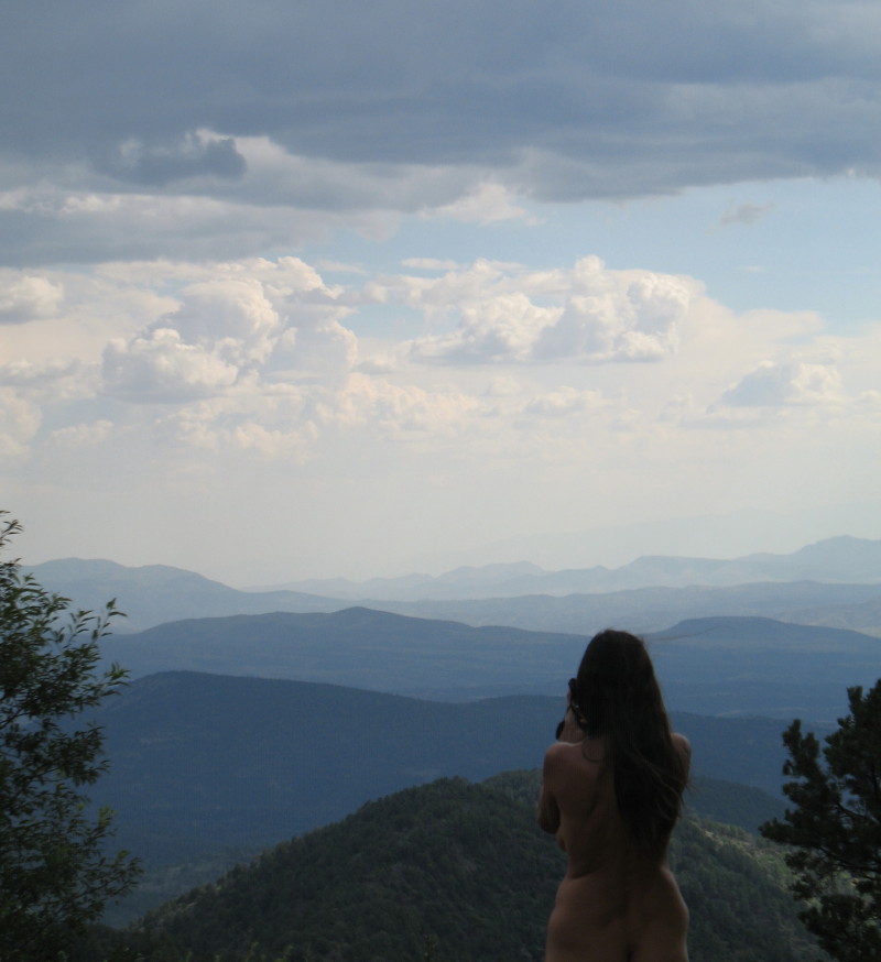
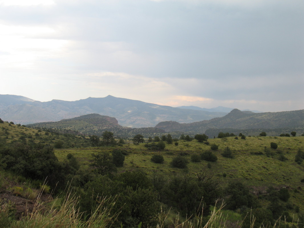
When I had time to glance away from the attention demanding road, the vistas were amazing in all directions and what I saw, near and far, was remote wild country.
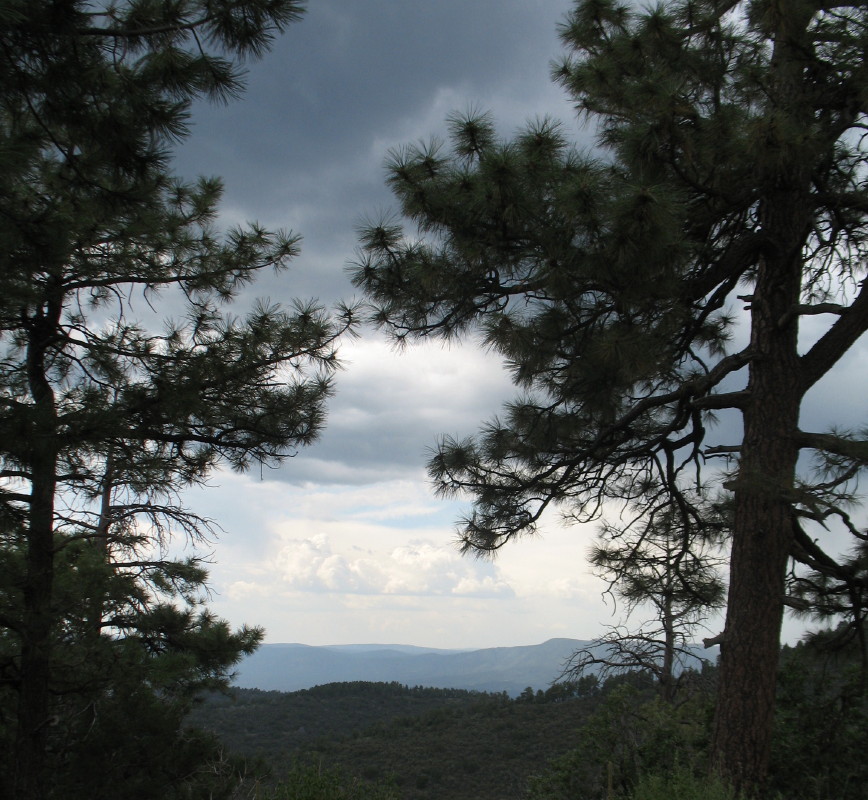
The skies were generally not raining.
As we got within probably twenty miles of our destination, I saw a huge thunder storm down below us. The grey cloud stood like a mushroom, dumping a grey mass into the area. “Ya see that storm down there? I think that’s where were supposed to go.” DF left no comment.
Juan Miller Road:
We arrived at the Juan Miller road in the rain, after traveling 60 miles and encountering maybe 6 vehicles. We were now in a warmer high desert area. We made a quick inspection of Juan Miller Campgrounds. They are in a small gorge of very thick riparian vegetation.

It was over grown and swamping wet.

I would have issues walking in it for fear of unseen snakes. Not really knowing what to expect of the 14 miles of road beyond and wanting an early start up the river canyon, we decided to push on.
The rain wasn’t a downpour at this time. That monsoon madness had left. However, everywhere there was flooding as the waters flowed away. The road was gravel, not pored gravel, but just lots of rocks. I jumped out to adjust the lockers for four wheel drive. As we slowly drove through the drizzle, the road was occasionally washed out, water still flowing.

The terrain there is very rocky.

The formations captivating, but when water hits them, it just heads downhill immediately, nothing stopping it. It accumulates quickly and soon creates flash floods of strong force.

These go over the road. The rain, now light drizzle, was not a problem, the washouts were. The drive would be around 13 slow cautious miles, eventually taking more than an hour.
Someplace Out There
There was a ranch house and no other human activity for many many miles in any direction. On the map, there might be one more ranch miles further.

The Road Ahead
The rain had stopped.

The streams of water still rushed across the road. At one point, I had to get out making sure that there was still road and just how steep and deep the washout was, below and ahead of us. I looked to my right and tall bunches of grass were flattened out in one direction. They indicated that the water had just been rushing through here at the bottom of my lift kitted door. Where we were about to cross the stream, it had been at least three feet deep and 100 feet across. This was a dangerous place when a cloud burst hit.
We were surprised to come across three young men with ATV’s dressed in that same camo, military style. They had sheepish looks on their faces. They looked guilty, but I didn’t figure out why. I rapidly grabbed a cloth over my waist and DF held her dress over her front as we crept passed and waved smiling. I wanted to stop, to gather information, but on the spur of the moment asking questions naked didn’t seem practical.
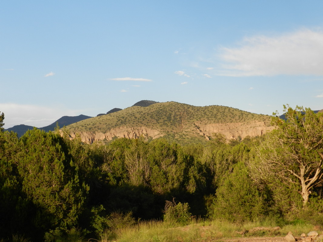
Eventually we began to see a rock face canyon a few miles ahead. That had to be it. We came to a sign, and ascertained that it was our road to take. A sign warned us, “4×4 only, steep grades, road closed two miles.” We trudged on. On the stereo, Pete Seeger played “Waste deep in the big muddy, and the big fool said to push on.”…nah…, BUT it was OMINOUS and this had been going for over an hour.
We passed through an even more challenging trail. Much of this place utilizes bare conglomerate rock formations, so the road was like old flaking concrete and slippery. The rest was just crappy. We went past the other’s camp. One tent tightly pitched under a lone pinion pine, with a tarp for a stove and yes, yet another white, late model pickup truck with the extended cab. The road degraded from here, I suspect that the other’s truck pulling an ATV trailer couldn’t continue and that is why they didn’t show the sense to not pitch a camp on a tall hillside, under the tallest tree in a lightning storm.
We trudged on. I was into four-wheel low and concerned. We had no information why the road was closed, or if it still went down to the old Triple XXX Ranch at the Blue River. It was evident that the canyon has steep cliffs hundreds of feet high and the old road would crawl down into it. We weren’t even positive that this was the correct road.
Finally, after another nervous 4×4 maneuver, I saw a place that was even more precarious. This road had turned into something that I would normally take with another vehicle as partner. It was unknown and dangerous, miles from…completely remote. It was demonstrating challenging driving that people do just for fun and looking too risky for my mood. It was getting late. It was a trick on the narrow cliffside, so we turned back.
Make Camp:
We had recently seen an old abandoned corral with a flat area. That would be a good safe camp.
We would decide what to do later, but we had just so much daylight. I found a spot with less likelihood to sheet wash if it rained. For quick set up, I chose the old cheap dome tent with the tarp over it. I managed to find enough soils before hitting solid rock for my stake’s purchase.

DF threw together a quick warm meal, a garlic/curry/vegetable/potato soup that I had previously made and a salad so varied that we didn’t use a dressing, but naked like us. We set up two chairs, sat down with food and drink, looked up and realized all was well.
This is a fantastic place, wild colorful rock formations , incredible vistas, views and there before us in the west, an amazing sunset.

A crescent moon was sharp to the south as a pair of bats flittered about in search for the evening meal. We felt at home in the desert. We enjoyed the warmth, the lack of mosquitoes and DF, determined, built a small fire to quietly play with in the night. Way out here alone, if anyone was to determine the dress code, it would have to be us.
As we drowned the hot coals we looked up. There are no major populations within hundreds of miles. The Milky Way was just like a cloud. The rest of the stars throughout the sky were so thick it seemed more silver than black between them. The sight was 360. Even with our plans disrupted, disappointment was futile.
