Bears Ears XXX
2024-06-03
I awaken to sunrise, calm, peaceful, I feel the dawning in the world around me. The alarm goes off at 7am, but I’m already alert and out of bed, I pack up camp. Not an ordeal today, just a routine in an orderly system. We take fresh morning air, stretch and eat, then we leave around 10am.
I check at the ranger station asking about any need of permits. None are needed. There’s an okay for fires in the mountains. No restrictions, no problem. They know nothing of the dead calf that we found up the road yesterday afternoon. We tell them about the illegal artifacts at our previous campsite. They’re concerned and take notes. Something with the word “Tortolita” comes up as DF and I browse maps. The Forester perks up. It’s a small world. We have a common friend in Tortolita.
Down the road the road-kill calf is gone and so is its grieving mom. Sad, yet it is good to know that things continue.
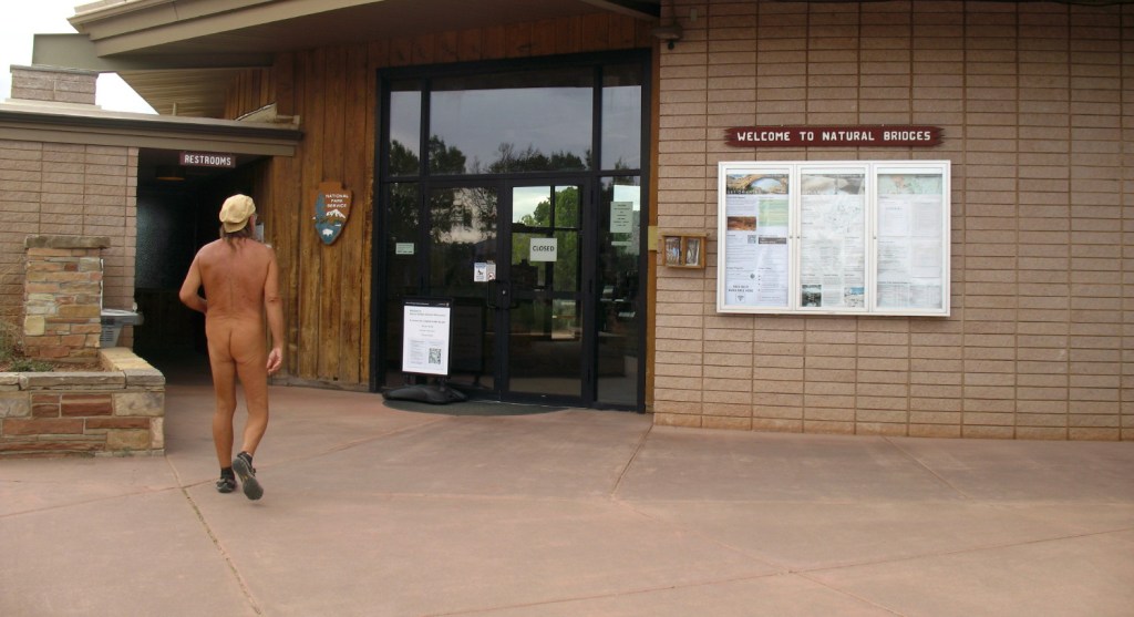
We’re off to the canyon park loop drive in Bridges National Monument. I pull up to the Visitor Center hoping for better details. I’m surprised that the facility is closed so close to Memorial Day. I peak into the window at the dark lobby. In the reflection, the parking lot is empty behind me. Might as well stay undressed! I’d been told that I’d get free wifi at the front door, but nothing comes out of the ethers there. The toilet rooms are open and clean. It feels liberating and comfortable, but a bit extra naked, wandering around a public area like that nude.
Down the road, we pull into a parking area. There are tourists parked every few spaces. A guy pulls up, climbs out of his sedan with his gal. There’s a pair of shorts hanging in the window. I suppose to shade out the sun. California plates, he may think that it is hot here. He smiles, but has serious eyes, sarcasm. Eighty billion for Ukraine and they can’t keep a VC open? Nobody there!”
I joke, “Well, at least we have indoor plumbing.”
I check my notes and books and plan the walk. We’re up on a mesa , looking down into the canyon park. It is a good touristy system with fantastic views.

The notes say that we’ll start here, climb down the cliff trail, walk through the canyon to the Horse Yoke ruins and then head back. The canyon bottom meanders pretty level at the bottom.
A couple are coming up, so I ask, “Didga get to the bottom?”
They smile and exclaim encouragingly, “Well worth it.”
A level down, we pass a pair of Frenchmen. They are arguing about the comparison of this and the Grand Canyon. Their wives sit quietly, stoic under umbrellas, awaiting what apparently is just another in a long series of arguments. These folks obviously have been together for a very long time, perhaps as brothers, or business partners. They won’t be going down only to have to climb back up either. I’m beginning to think that it may be pleasantly private down there. I don’t see many cars and from here it looks to be a long deep 500 foot drop.
Curiously, there are a various styles of stairs leading us down, which provide easy descending walks, as each easy slope has a switchback.

We listen to the clang of a metal staircase under our feet.

The next set of steps are primitive chips carved out of the rock surface.

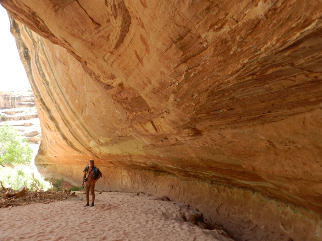
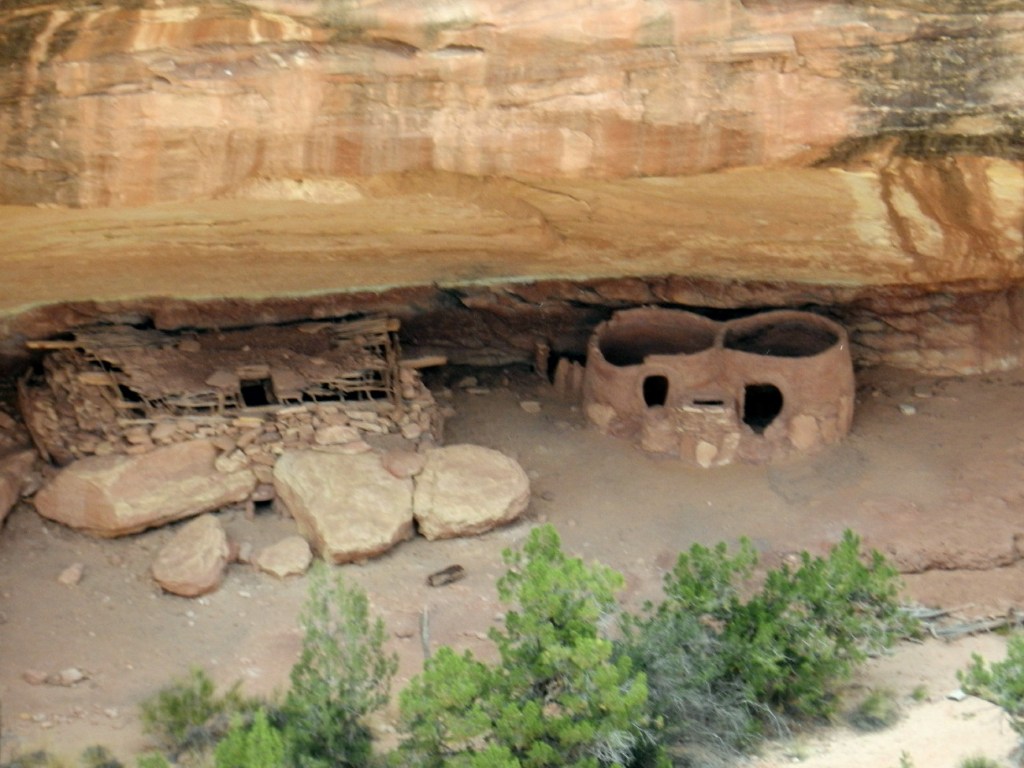
Along the way we come across a reconstructed ruin. There is suit on the surface above it from ancient fires. It has a superior view of the Grand Arch below. It would seem that people would decide to turn around here. The walk gets less civilized from here, a steeper drop, more challenge.

Some places near cliff sides have railings made of plumbing pipe, which was drilled and cemented into the solid stone surface.


There are steep metal ladders, flagstone steps and slippery sandy slopes.


For a short stretch cairns are in a row directing us on a rock surface where no treading marks will be seen.

Then wooden framed steps are under our feet. It is all pretty easy, however a 500 ft. climb out.
One middle aged couple greet us in passing. They have excited expressions on their faces. They’ve experienced something special.


Arriving at the bottom, we see many fewer footprints. As we sit on the convenient log, we look up at the natural bridge’s underbelly. Trying to get a full camera shot of the arch is difficult, even with a wide-angle lens.

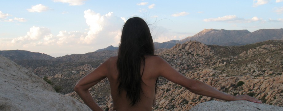
I begin to consider the potential of meeting someone and the comfort of hiking nude. Most people walk a few feet from the curb and view down and out. Braver ones and a few able bodied, climb to the next level, where the previously mentioned ruins were. Fewer still make it down here to the bottom. Obviously, only a handful hike the loop trail along the canyon bottom and that’s where we will find a naked hike.

It is evident that his is our kind of territory from here on. Naked feels really good right now and being away from the crowds. It’s quiet, peaceful. The walls rise, diminishing the turquoise sky above, a magnificent hallway. We’re at the canyon floor, the flow and elevation does change only slightly and we know that there are ruins.

The Horse Rack ruins are ancient granaries with an unusual arched lentil at the entrance.

We also know of a 60 foot pictograph panel. We find our way.

We don’t know how far each landmark is, or how far we have come, but we keep a diligent eye out for the art and architecture.

This trail travels through thick brush and tall grasses. It is not maintained officially, only by the occasional rains and occasional walker’s paces.

We spend much of our time walking through the creek bed of beach sand, or rounded smooth river-rocks. Sometimes it is stone, or a slab, or pebbles, or a bedrock solid surface.
Around a bend and into another, we come face to face with a wall of handprints.

Mud splatter dyes, or paints are on the sandstone overhang. There is a lone hunter stick figure amongst a tribes worth of handprints.

I look around and find that agave still grows in patches here, a remnant of bygone farming.

This was once a beach with a pond. Eight hundred years ago, give or take 200 years, people lived here in a farming garden. This is where natives would skinny dip, refresh, work some more, dip again. They kept watch, lived in seasonal huts, frolicked, and came over to brand their marks on the rock wall as signatures. They surely came back to their personal handprints and friends prints again and again, as time in their lives passed. Memories of the day that these marks were made would come back to them. Standing naked here, I can almost imagine it all around me. I see an overlay, a vision of a warm day that has passed, the air, the smell, the many nuances that still flourish here.
Then I see the white top of a large RV high up above and then two figures gazing down.

Would they believe that they saw a nude man down here? Would they have binoculars? Would anyone complain? DF slips down her light dress for convenience. For comfort, she has been rolling it up. I debate rewrapping my kilt.
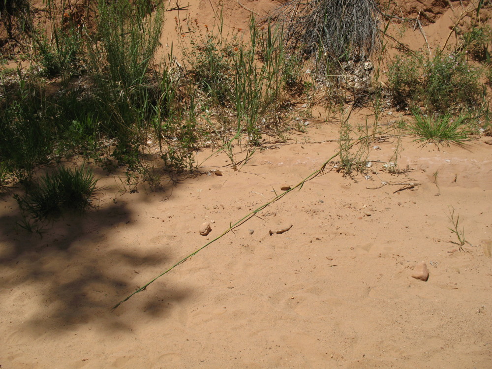
A tough grass crosses the sand. Flora has amazing adaptation. Here flash floods turn topsoil into a sandy surface, but this stuff finds a foothold and starts to catch passing nutrition, dust and debris to make a living.
We continue in search of the horse granaries. Up on a bedrock slope are ruins, but apparently not them.

We continue, but eventually we’re realizing the heat, the time and the climb back up. There are other sights to see along the loop above in this park and then, we still have to travel to the next camp set up. We turn back. I don’t know where the horse rack door thing is. We could potentially use another hour down here to find it.
At the top, there are fewer spectators, now. No Frenchmen debating, no wives sitting passively, no Oregon, Utah, Arizona, Florida, Connecticut, or Colorado license plates. No German wives who don’t know the local language. No RV’s. The latest fancy camping rigs are gone, leaving just a friendly couple here and there.

I’m back in kilt, DF in various clothing. I hold tight to my hat.

High winds have come up since our descent. Safety railed platforms of rock are here to reveal stunning vistas.


From here, I see can where the two figures stood looking down at us. I look far down at the pictographic hands with these new high power binoculars. There is also view of the granaries.
There, next to them, is the ruins that we photographed. We were there and missed the objective by a couple of hundred feet!

After two more arches, we’re off to that lonely little spot near a stone wash and an old wooden bridge, to camp under a shade tree. The moon is gone. The very dark skies out here reveal stars as a constellation of light flowing like milk.
I am on the forum of FreeRangeNaturism.com often, if you would like to converse.
© The owners of TheFreeRangeNaturist.org as of the year 2015 declare. Unauthorized use and/or duplication of this material without express and written permission from this site’s author and/or owner is strictly prohibited. Excerpts and links may be used, provided that full and clear credit is given to TheFreeRangeNaturist.org with appropriate and specific direction to the original content.

Loved this post—raw, peaceful, and full of freedom. If you ever want a similar naked adventure vibe, Nepal is perfect. In Kathmandu’s Thamel and up in the Himalayas—Everest, Annapurna, and more—you’ll find open trails, quiet nature, and total freedom. You’d feel right at home here.
LikeLike